Geoscience Reference
In-Depth Information
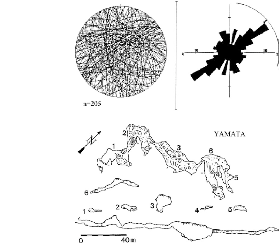
Fig. 3.50
Joint directions in
the Dobrostan karst plateau
(205 measurements)
Fig. 3.51
Map, cross
sections, and longitudinal
profile of Yamata Cave
(modified after Pandev
1993
)
(breakdown), clay sediments with varied thickness
and speleothems, including rare helictites. Yamata
Cave was mapped during the National speleoexpedi-
tion ''Dobrostan 1975'' by Boris Kolev from Caving
Club ''Aida'' (Haskovo) and Ivan Dermendzhiev from
Caving Club ''Galata'' (Varna) (Fig.
3.51
).
The studies conducted in the cave in September
2005 and May 2007 established multiple deforma-
tions of speleothems (Kostov and Shanov
2006
;
Kostov
2008
; Kostov et al.
2009
). The deformed
formations
the fallen fragments is 50 cm, but are distributed and
massive fallen stalagmites with a height of 1.4 m. All
the
fallen
speleothems
are
covered
with
calcite
depostis of different thickness.
(B) Inclined to the north massive stalagmite with
height of 1.7 m and diameter of 1 m with new
vertical stalagmite formed on the inclined surface
(Fig.
3.52
).
(C) Diagonal crack in massive stalactone with
diameter 1.4 m.
Based on the data on the orientation of the fallen
stalagmites was built a rose-diagram (Fig.
3.53
). The
analysis of the preferred directions indicates three
distinct maxima. The three peaks suggest the impact
of more than one phase of intense seismotectonic
activity during the Quaternary. The discussion on the
are
widespread
and
evenly
distributed
along
the cave
gallery. The
deformations
can
be
separated in the following morphological types:
(A) Fallen stalagmites. Their large number com-
pared to the total area of the cave shows the impact of
catastrophic tectonic events. The average length of