Geoscience Reference
In-Depth Information
150° 35 '
150° 40'
150° 45'
150° 50'
34° 45'
Foys Swamp
Tsunami wave
crest
Tsunami
flood paths
Tsunami
backwash
34° 50'
Inland limit
of tsunami
flooding
Delta and
floodplain
Marsh or
swamp
Sand barrier
Tsunami
backwash
channel
Shoalhaven
River
34° 55'
Crookhaven
River
0
5 km
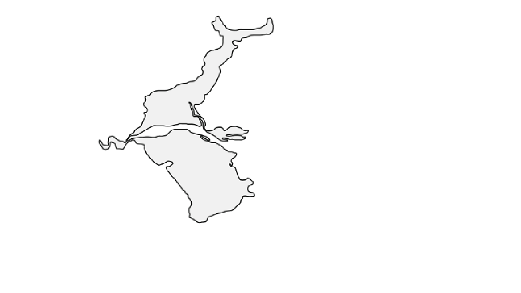
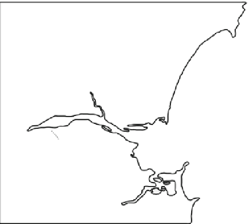
Fig. 4.4
Hypothesized tsunami overwashing of the Shoalhaven Delta,
New South Wales, and the meandering backwash channels draining
water off the Delta. A tsunami event 4730-5050 years ago—as
determined from shell buried within a tapering sand layer within the
delta—probably created these channels. The extent of this marine
layer is also marked. A younger tsunami event around AD
1410 ±60 years may also be implicated in the formation of the
backwash channels. Based on Young et al. (
1996b
)
southeast corner of the delta. The channels had a maximum
discharge of 500 m
3
s
-1
based upon the length of meanders.
The modern Shoalhaven River has a bankfull discharge of
3,000 m
3
s
-1
in flood. Many smaller streams were once
tidal, but the channels have since undergone infilling with a
reduction in their carrying capacity. The channels are
600 years old, coinciding with the regional age of a large
paleo-tsunami predating European settlement. This age was
obtained from oyster shells found on a raised pile of
imbricated boulders that were swept into the entrance of the
Crookhaven River as the tsunami approached from the
south. The wave then climbed onto the delta via this entrance
and the main channel of the Shoalhaven River (Fig.
4.4
).
The inferred direction of approach coincides with the
alignment of nearby boulders deposited by tsunami on cliffs
rising 16-33 m above sea level (Fig.
3.13
). The tsunami also
swept over a coastal sand barrier and onto the northern part
of the delta (Foys Swamp), depositing a layer of sand and
cobble 1.8 km inland of the modern shore. The small
meandering channels on the southern part of the delta were
created by southeast drainage of backwash from the deltaic
surface after the tsunami's passage northwards up the coast.
in Figs.
4.1
and
4.5
respectively. The two models can be
differentiated from each other by their degree of dissection.
Smooth, small-scale bedrock-sculptured landscapes are
restricted to headlands less than 7-8 m in height. Features
consist of S-forms and bedrock polishing, and rarely exceed
a meter in relief. Dump deposits and imbricated boulders
usually are present nearby. The S-forms are directional,
paralleling each other and the orientation of any imbricated
boulders. The landscape is dominated on the side of head-
lands facing the tsunami by fields of overlapping mus-
chelbrüche and sichelwannen grading into V-shaped
grooves as slopes steepen. Where vertical vortices develop,
broad potholes may form, but rarely with preserved central
bedrock plugs. Crude transverse troughs develop wherever
the slope levels off. At the crest of headlands, mus-
chelbrüche-like forms give way to elongated fluting. The
flutes taper downflow into undulating surfaces on the lee
slope. Sinuous cavitation marks and drill holes develop on
this gentler surface wherever flow accelerates because of
steepening or flow impingement against the bed. On some
surfaces, a zone of fluting and cavitation marks may reap-
pear towards the bottom of the lee slope because of flow
acceleration. Cavettos or drill holes develop wherever ver-
tical faces are present. While cavettos are restricted to
surfaces
4.4.3
Rocky Coasts
paralleling
the
flow,
cavitation
marks
are
ubiquitous.
Irregular, large-scale, bedrock-sculptured landscapes are
most likely created by large tsunami generated by sub-
marine landslides and asteroid impacts with the ocean. The
There are two distinct models of sculptured landscape for
rocky coasts: smooth, small-scale and irregular, large-scale
(Bryant and Young
1996
). These are shown schematically