Geoscience Reference
In-Depth Information
Table 4.2
Comparison of tsunami and storm wave heights required to transport boulders along the Queensland coast north of Cairns
Location
Boulder width (m)
Weight (tonnes)
Height of tsunami at shore (m)
Breaking storm-wave height (m)
Cow Bay
6.3
247.0
11.2
44.8
Oak Beach
4.0
192.0
5.0
20.0
Taylor Point
4.2
90.0
9.1
36.4
Turtle Creek Beach
4.3
115.0
5.2
20.8
Cape Tribulation
4.1
86.0
5.8
23.2
Source Based on Nott (
1997
)
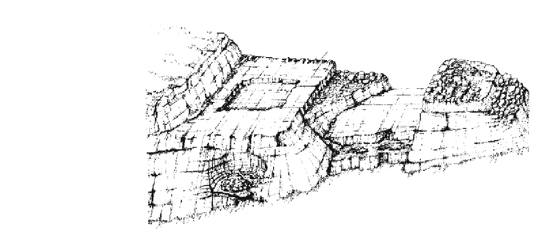
Fig. 4.1
Model for irregular,
large-scale, sculptured
landscapes carved by tsunami.
Model is for headlands 7-20 m
above sea level. From Bryant and
Young (
1996
)
Toothbrush-shaped headland
Ramp
Raised platform
Potholes
Hummocky
topography
Flutes
Canyon
5 m
Truncated cliff
Cascade or falls
0 m
5 m
Approximate scale
0 m
Whirlpool with central plug
literature. Along the New South Wales south coast, imbri-
cation is a dominant characteristic of boulder piles and a
signature of tsunami (Young et al.
1996a
). For example, at
Tuross Heads, contact-imbricated boulders with an
upstream dip of 30-50 are piled en echelon in two single
files over a distance of 150 m. This pattern is similar to that
produced in erosive fluvial environments by high-magni-
tude, unidirectional flow. The size of the imbricated boul-
ders not only matches that produced by high-magnitude
flows in streams but also that produced by the catastrophic
flows hypothesized for meltwaters in front of, or beneath,
large glaciers (Table
4.2
).
record. Rarely do facies models consider bedrock erosion.
For example, while much literature has been written on the
formation of beaches with their attendant surf zones and the
long-term development of sandy coastal barriers, little has
been written on the erosion of rocky coasts by waves. What
has been written is elementary and perfunctory. What is a sea
cave, a coastal stack, or an arch? The literature frequently
refers to such features but sheds little light as to their for-
mation, especially in resistant and massively bedded bed-
rock. Even the formation of rock platforms, the most studied
feature of rocky coasts, is ambiguous. Erosion of platforms
across bedrock of differing lithologies or structures is
attributed to long-term wave abrasion or chemical erosion—
processes that have been measured at localized points but
never broadly enough to establish them as the main process.
Catastrophic tsunami waves have the power to erode such
surfaces in one instant. Many other aspects of cliffed and
rocky coasts are treated in a similarly cursory fashion. If sea
caves, stacks, arches, bedrock-ramped surfaces, sheared
cliffs, imbricated boulder piles, and chevron ridges are the
signature of tsunami, then how common are catastrophic
tsunami in shaping the world's coastline? (Fig.
4.1
).
4.4
Types of Coastal Landscapes Created
by Tsunami
The modeling of spatial variation in modern sedimentary
environments dominated by a specific process is termed a
facies model. These models are well formulated for many
processes such as tides, rivers, and waves (Walker and James
1992
). Facies models are used to interpret the geological rock