Geoscience Reference
In-Depth Information
Fig. 3.22
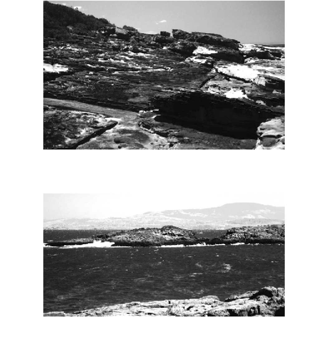
The ramp at Bannisters Head on the New South Wales
south coast. The tsunami wave approached from the bottom right-hand
corner of the photograph. Erosion increases up the ramp that rises
16 m above sea level. The blocky boulders at the top of the ramp are
over 4 m in diameter
Fig. 3.23
Canyon feature cut through the 20 m high headland at
Atcheson Rock by a tsunami moving from bottom left to top right.
Evidence exists in the cutting for subsequent down cutting of 2-4 m
by a more recent tsunami. The latter event also draped a 0.5-2.0 m
thick dump deposit over the headland to the right. This deposit has
been radiocarbon dated at around AD 1500. The small potholes in
Fig.
3.21
are located on the leftmost portion of the headland, while the
large whirlpool shown in Fig.
3.26
is located on the far side of the
canyon
horizontal vortices to form in the lee of stacks and erode
promontories from their landward side (Fig.
3.25
).
Perhaps the most impressive features are whirlpools
formed in bedrock on the sides of headlands. Whirlpools
and smaller potholes commonly formed under catastrophic
flow in the channeled Scablands of Washington State
(Baker
1981
). Potholes with a small central plug have been
found under catastrophic flow in glaciated landscapes (Kor
et al.
contain a central plug of rock and show evidence of smaller
vortices around their rim (Bryant and Young
1996
).
Whirlpools can reach 50-70 m in diameter with central
plugs protruding 2-3 m vertically upwards from the floor of
the pit at the quiescent center of the vortex. The best coastal
example occurs on the south side of Atcheson Rock south of
Bass Point, New South Wales (Fig.
3.26
). Here a large
vortex, spinning in a counterclockwise direction, produced
smaller vortices rotating around its edge on the up flow side
1991
). In
coastal
environments,
whirlpools often