Geoscience Reference
In-Depth Information
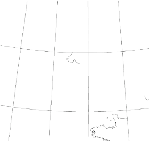
Fig. 7.16
Location map of the
Bristol Channel, U.K. Black area
shows extent of the 1607 flooding
Ireland
Porcupine
Bank
Porcupine
Bight
Sole
Bank
Goban
Spur
Celtic
Margin
Depths in meters
Carmarthen
Wales
Gloucester
Severn
Estuary
Sudbrook
Sker Pt.
Newport
Worms Head
Cardiff
Tears Pt.
Ogmore
Sully Is
Bristol
Channel
Portishead
Dunraven
Kingston Seymour
Brean Down
Burnham-on-Sea
Ilfracombe
Croyde
Appledore
Barnstaple
England
0
25 50 75 km
Areas with recorded flooding
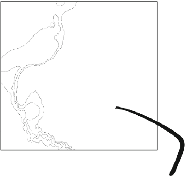
a shallow vortex pool with a central plug (Fig.
7.18
). This
feature is similar to those produced along the New South
Wales coast by mega-tsunami (Fig.
3.21
). Hummocky
topography representing the presence of a myriad of vorti-
ces exists on a ramped surface rising above the level of high
tides at Worms Head. Finally, there are indications that
tsunami have reshaped some of the rocky coastline in the
channel. At Sully Island west of Cardiff, Triassic Red Beds
overlie Carboniferous Limestone. Here, a raised platform
surface 3-4 m above high-tide mark has been eroded with
removal of the weaker Red Beds. At Ball Rock, 0.5 km up
the channel and sheltered by Sully Island from storm waves,
erosion has generated an inverted toothbrush-shaped head-
land (Fig.
7.19
) similar to those generated by high velocity