Geoscience Reference
In-Depth Information
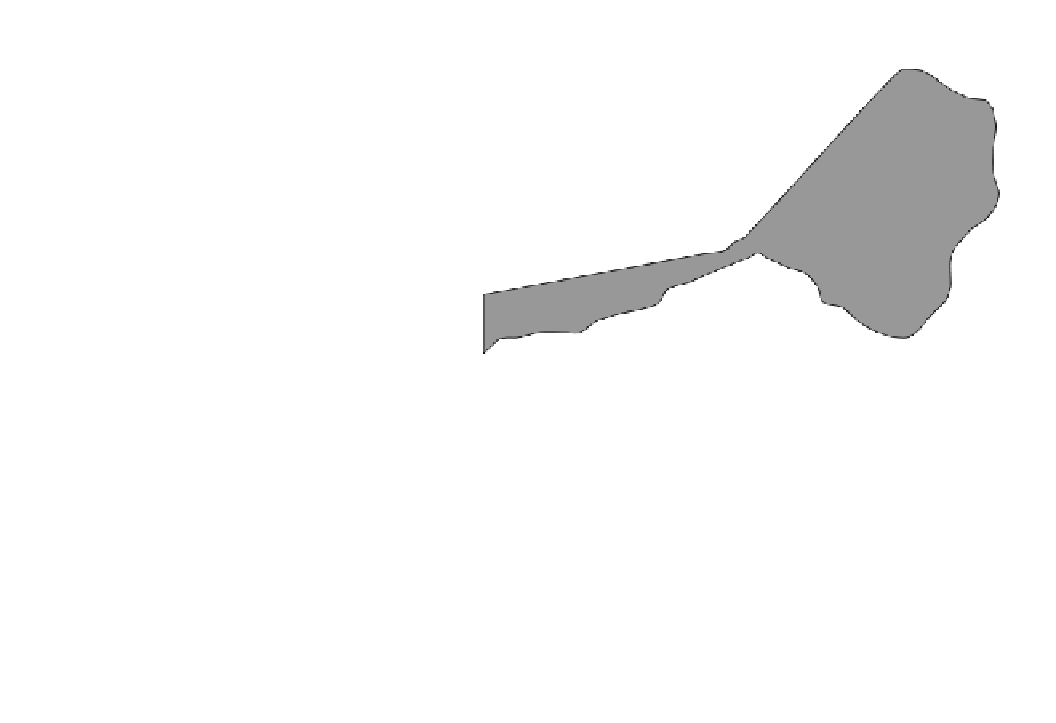
Fig. 7.7
Location of the Grand
Banks earthquake of November
18, 1929 and the Burin Peninsula
of Newfoundland affected by the
resulting tsunami
-65°
-60°
-55°
-50°
-45°
50°
Newfoundland
Gulf
of St.
Lawrence
48°
Grand
Banks
Burin
Peninsula
46°
Sable Island
44°
Halifax
42°
Earthquake epicentre
40
°
St. Pierre and
Miquelon
Lord's Cove
Taylors Bay
Lamaline
0 50 km
2,200 km length of the Hawaiian Ridge (Moore et al.
1994b
),
between the main island of Hawaii in the southeast and
Midway Island in the northwest (Fig.
7.8
). The average
interval between events is estimated to be 350,000 years.
Because shield volcanoes typically have triple junction rift
zones, amphitheaters are cut into the volcano at the headwall
of giant landslides (Carracedo et al.
1999
). If landslides have
been ubiquitous on an island, then the island takes on a
stellate shape termed a Mercedes star. On older volcanoes,
these head scarps may be buried by subsequent volcanic
activity (Moore et al.
1994b
). Some of the largest landslides
occur near the end of shield building when a volcano stands
2-4 km above sea level. The major trigger for the avalanches
are earthquakes on the younger islands; however, on the
older islands mass failures are even triggered by storm surges
and internal waves. The length of the slides increases from 50
to 100 km for the older western volcanoes to 150-300 km
for the younger eastern ones—making them some of the
longest slides on Earth. The volume of material in each slide
is as much as 5,000 km
3
(Masson et al.
1996
,
2006
). Smaller
landslides having volumes of tens of cubic kilometers have
also been detected in shallower waters but not mapped in
detail because of the difficulty of using side-scan sonar at
these depths. In total, about half of the volume of the
Hawaiian Ridge consists of landslide material. The landslides
can be grouped into slower-moving slumps and faster-mov-
ing debris flows. The latter have the potential for generating
colossal tsunami wave heights.
Slumps have an internal consistency whereby large
chunks slough off from a volcano along fault lines or rifting
zones to a depth of 5 km (Moore et al.
1994b
). Parts of
slumps may produce smaller debris avalanches. Slumps and
their resulting tsunami are historically common in Hawaii.
In 1868, slumps associated with an earthquake with a
recorded magnitude, M
s
, of 7.5, produced a 20 m high
tsunami that killed 81 people. In 1919, a similar magnitude
earthquake produced a submarine landslide off Kono that
resulted in a 5 m high tsunami run-up. In 1951, a small
earthquake generated a local tsunami at Napoopoo. Two
hours later, part of a cliff fell into Lealakakua Bay and
generated another local tsunami. Most recently in 1975, an
earthquake again with a recorded magnitude, M
s
, of 7.5
caused a 60 km section of the flank on Kilauea to subside
3.5 m and to move 8 m into the ocean. The resulting tsu-
nami had a maximum run-up height of 14.3 m, killing two
people.
Submarine debris avalanches are morphologically simi-
lar to those witnessed on volcanoes on land where speeds of