Geoscience Reference
In-Depth Information
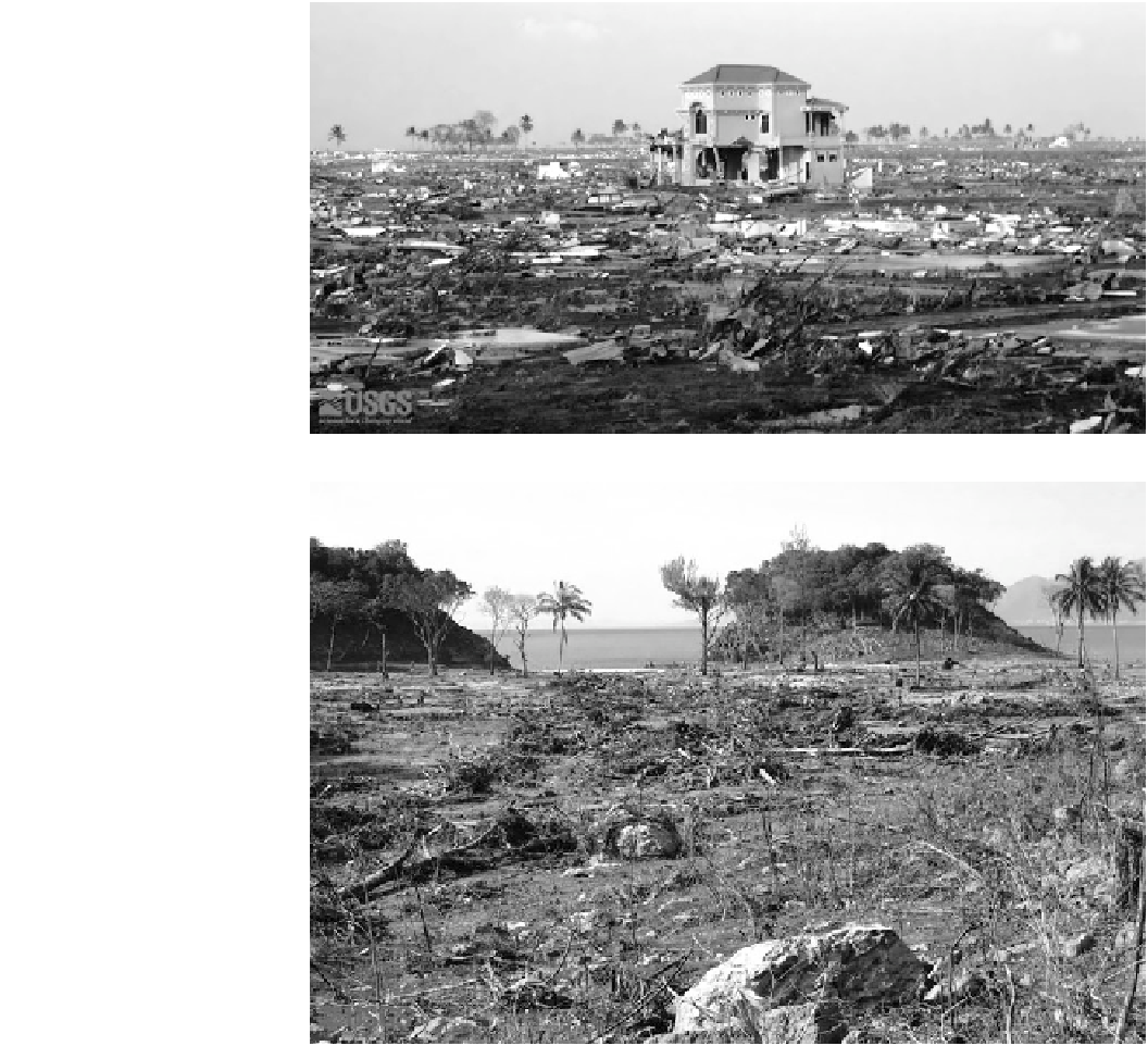
Fig. 6.14
Total destruction of
the urban landscape at Banda
Aceh. Only houses and mosques
made out of concrete were left
standing. Source Guy
Gelfenbaum, U.S. Geological
Survey.
http://walrus.wr.usgs.
Fig. 6.15
Site of Seaside Resort
Hotel north of Leupueng on the
west coast of northern Sumatra.
Here the flow depth exceeded
10 m, scouring the soil from
hillsides and depositing a mixture
of sand, clay and boulders across
the flatter plain. Compare this to
the similar landscape produced
by Flores, Indonesia Tsunami of
December 12, 1992 shown in
baum, U.S. Geological Survey.
Japanese Meteorological Agency responsible for triggering
Pacific Tsunami alerts underestimated the size of the event,
initially assessing it as a 7.9 magnitude event—about 36
times less energy than actually occurred. As shown
throughout the preceding chapters, this coastline of Japan has
a well-documented history of tsunamigenic earthquakes. The
largest historical events were the 1896 Meiji and 1933 Showa
Tsunami. Geological evidence suggests that there have been
large ones every 800-1100 years (Minoura et al.
2001
).
The triggering earthquake—known as the Great East
Japan Earthquake—ruptured an area roughly 300-500 km
long and 200 km wide on the boundary between the sub-
ducting Pacific Plate and an overlying extension of the
North American Plate 200 km offshore of the T ¯hoku coast
(Fig.
6.16
b). The Pacific Plate is moving westward at a rate
of 8-9 cm per year and effectively drags the overlying plate
downwards until the accumulated stress causes a seismic
slip-rupture event. The T ¯hoku sequence began on March 9
with a magnitude 7.3 M
w
earthquake that produced a 0.5 m
tsunami in Ofunato (The Asahi Shimbun
2011
). The March
11 rupture lasted 6 min starting with a slow rupture over a
large area of the subducting plate that accelerated upslip,
eventually leading to over 7 m of vertical motion of the
seabed (Kanamori
2011
; Ozawa et al.
2011
; Pollitz et al.
2011
). The end process generated most of the tsunami. The
Japanese sea floor and coast west of the slip subsided by up
to 1.2 m over a distance of 400 km. Over 1800 aftershocks
occurred, with 80 registering a M
w
magnitude over 6.0 and
three a M
w
magnitude over 7.0 (The Asahi Shimbun
2011
).
The Japanese Meteorological Agency, which is responsible