Geoscience Reference
In-Depth Information
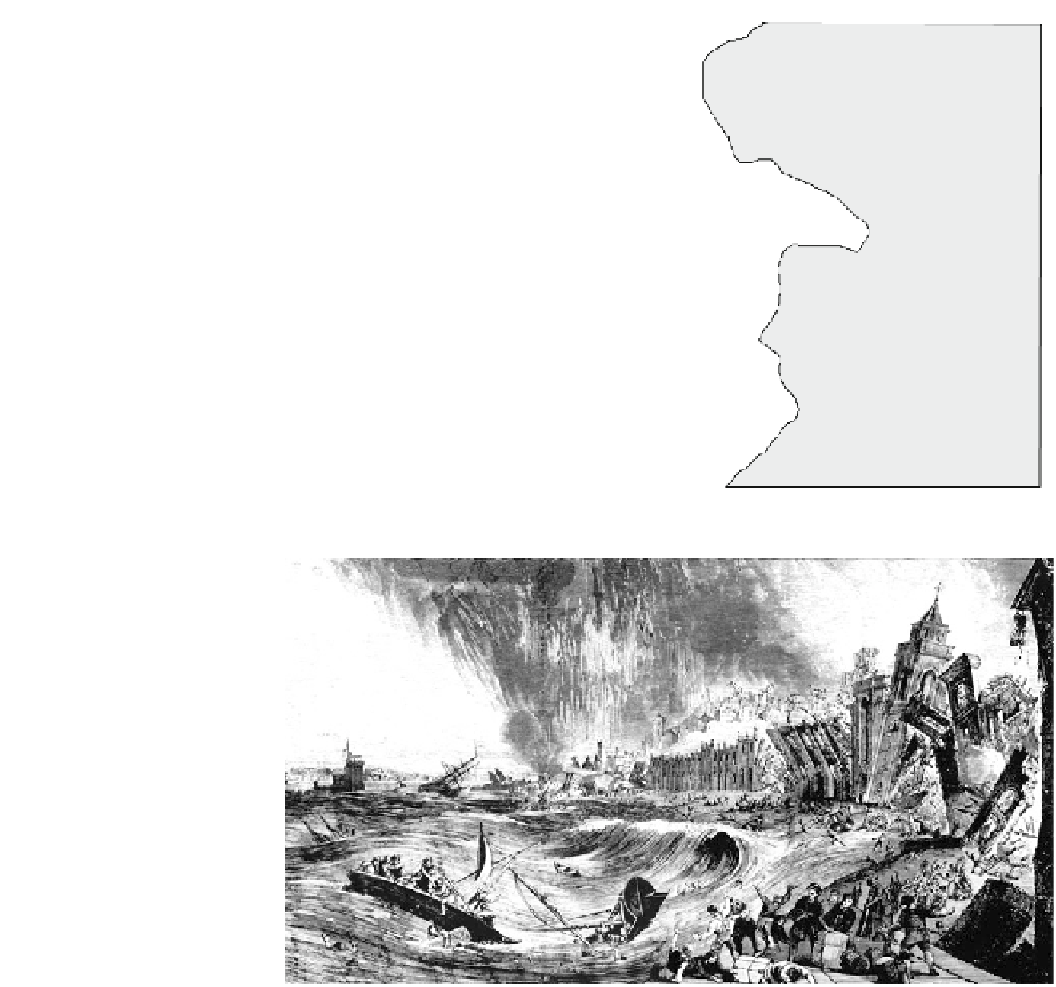
Fig. 6.2
Location map for the
Lisbon Tsunami event of
November 1, 1755
-
3
0°
-20°
-10°
0°
1
0
°
55°
North
Sea
Scilly Isles
50°
Atlantic Ocean
45°
Lisbon
40°
Azores
Islands
Algarve
Cádiz
Earthquake
epicentre
Boca do Rio
Algiers
35°
Tangier
Fez
Gibraltar
Madeira
Islands
Mequinez
Agadir
30°
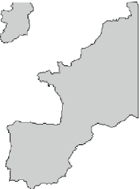
Fig. 6.3
Wood engraving by
Justine of the tsunami sweeping
up the Tagus River, Lisbon,
following the November 1, 1755
earthquake. Note that the
earthquake, subsequent fires, and
tsunami have been incorrectly
drawn as occurring at the same
time. Source Mary Evans Picture
Library Image No. 10047779/07
level—and higher than run-up elevations recorded elsewhere
in the region (Scheffers and Kelletat
2005
). Along the
Algarve coastline of southern Portugal (Fig.
6.2
), the main
wave and eighteen secondary ones swept over the barrier
coast (Andrade
1992
; Hindson et al.
1996
). At least four
other tsunami subsequently affected the same coast between
1755 and 1769. Their impacts form the basis for the model of
a tsunami effect on barrier coasts presented in the
Chap. 4
wash deposits, infilled lagoons, and led to the creation of a
backbarrier flat up to 800 m wide lying 4.0-4.5 m above
high tide. A narrow foredune ridge now fronts this flat sea-
ward. The flats today are poorly vegetated, with hummocky
topography that traces out a labyrinth of second order
drainage channels developed in response to tidal flooding
through numerous inlets punched through the barrier by the
tsunami. A lag of iron-stained gravels was left on the channel
surfaces. The channels merge into first-order meandering
ones that are incised progressively seaward into the back-
barrier at the location of tidal inlets. The latter formed either
major conduits for backwash or short-lived tidal inlets as the
barriers recovered. Despite a tidal range of almost 4 m, most
tidal inlets closed because the available tidal prism was
insufficient to maintain strong enough currents to flush out
sediment. Remnant channels are today truncated seaward by
a foredune that has developed in the past 200 years. Some
tidal inlets developed wide, flood-tidal deltas in the lagoon.
These
underwent
extensive
reworking
as
tidal
currents