Geoscience Reference
In-Depth Information
the likelihood and physical characteristics of tsunamis (i.e., the hazard), the personal or situ-
ational conditions that increase the susceptibility of people or resources to harm from the
tsunami (i.e., vulnerability), and associated uncertainties.
This chapter irst introduces tsunami risk assessment by identifying roles it may play in
reducing the losses of life and property to tsunamis and by summarizing broad approaches
to risk assessment. The rest of the chapter reviews progress in assessing tsunami hazard and
tsunami vulnerability. Aspects of perceptions, knowledge, and preparedness levels that inlu-
ence individual resilience are discussed in the following chapter.
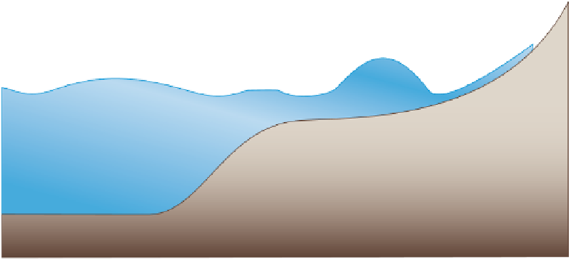
TSUNAMI FORM IN THE OPEN OCEAN
NEARSHORE TSUNAMI FORM
d
I
H
R
CONTINENTAL
SHELF
INITIAL
SHORELINE
CONTINENTAL
SLOPE
ABYSSAL PLAIN
H = tsunami wave height
R = run-up height
d
I
= inundation depth
The depth in the continental shelf is typically less than 200 m.
The average depth in the abyssal plain in the Pacific is about 4,000 m.
The deinition of tsunami run-up height. SOURCE: Committee member.
Figure (Box 2.1).eps
maps but these zones are typically enlarged to allow easier identiication of landmarks, such as major
intersections or highways.
Evacuation modeling
refers to the process of simulating how people evacuate any given area
and is used to quantitatively evaluate whether high ground can be reached in time.