Geology Reference
In-Depth Information
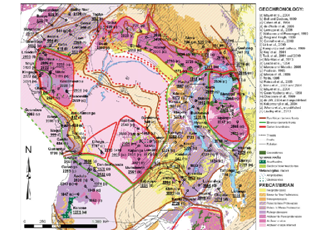
Fig. 2.5
Detailed Precambrian map of basement surrounding the CB (GIS database from de Wit et al.
1988
, modified), with selected dates from
the literature.
Underlined numbers
are U-Pb zircon dates, in millions of years (Ma)
boundary zone (200-250 km wide) between the SWCC and
the Angola region to the south may represent an Eburnian
exhumed
type-zone, formed during
prolonged southward under-thrusting of the Kasai Craton
beneath the Angola basement, forming an Eburnian paleo-
Tibet like Plateau with low pressure granulite formation and
prolonged alkaline magmatism (2300-1300 Ma) and wide-
spread rapakivi granites as old as 2065-2068 Ma (U/Pb
zircon TIMS dates; Doucoure et al.
1999
). The Angola
region stretches ca. 1,000 km south towards its tectonic
contact with the Kaoko-Damara Belt in Namibia, a contact
boundary that contains slivers of Archean gneisses (ca.
2580-2620 Ma) within the Eburnian-Kibaran granitoids of
the Angola basement (e.g. Miller
2008
). Near its southern
margin this Angola basement is overlain unconformably by
relatively undeformed Paleo-Mesoproterozoic sedimentary
rocks (Chela Group, ca. 1790 Ma McCourt et al.
2004
), and
intruded by the vast Mesoproterozoic mafic-anorthosite
complex of Kunene at 1371 Ma (U-Pb zircon date; Mayer
et al.
2004
) associated with widespread red granites and
syenites dated around 1400-1300 Ma (Carvalho et al.
2000
).
'
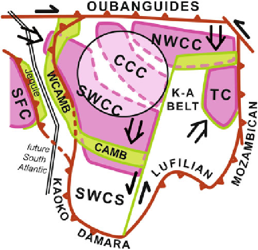
Alpine-Himalaya
'
Fig. 2.6
Schematic diagram of the formation of the Central African
Shield (CAS)
Search WWH ::

Custom Search