Geology Reference
In-Depth Information
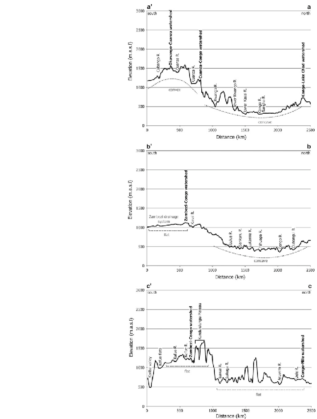
Fig. 15.6
(
a
) The western most
cross section from a (north) to a
'
(south) with the location of major
rivers and major watersheds
(Okavango-Cuanza,
Cuanza-Congo and Congo-Lake
Chad) marked in
bold
. Note the
convex topography of the
Angolan Highlands region to the
south and the concave profile to
the north, which also includes the
lower Kwango River. (
b
) The
central north-south cross section
depicting the gentle slopes of the
CB system to the north and
gradual transition towards a
convex shape below the Zambezi-
Congo watershed in the south. (
c
)
Two first order landscapes are
visible, a high, flat landscape at
ca
. 1,000 m.a.s.l in the south and
a low, flat landscape at
ca
. 500 m.
a.s.l. The high, flat landscape is
punctuated by the topographic
spike of the Kundulungu Plateau.
The northern, low, flat landscape
has several elevation spikes,
representing the Western Branch
of the EARS in the form of the
eastern highlands of the Congo
Basin. The trough of the Gwembe
graben (Kariba valley) is
conspicuous in the south. The
watershed between the Zambezi-
Congo and Congo-Nile are
shown. The Kundulungu Plateau
lies northward of the Zambezi-
Congo watershed and is of a
greater elevation than the
watershed, representing a major
deviation from the overall
cross-section. The transition from
the Zambezi to Congo system
does not exhibit the general
convex nature that is seen in the
profiles further west (Fig.
15.6a,
b
), with rivers in the region
incised to similar elevations
Search WWH ::

Custom Search