Geology Reference
In-Depth Information
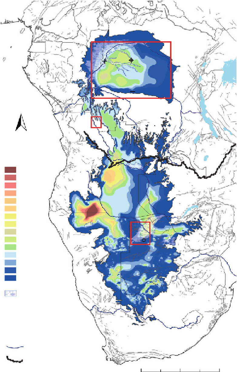
Fig. 10.2
Isopach map of the
Kalahari Group, extended from
Haddon (
1999
) by Linol (
2013
).
Three study areas referred to in
the text are shown by
red
rectangles
Mbandaka
Samba
1
L. Victoria
Gils
on
Dekese
L. Tanganyika
N
Kalahari thickness
420-450 m
390-420 m
360-390 m
330-360 m
300-330 m
270-300 m
240-270 m
210-240 m
180-210 m
150-180 m
120-150 m
90-120 m
60-90 m
30-60 m
0-30 m
L. Kariba
4
Tsodilo
2
3
Ngami
Active wetlands
1
: West Congo Swamps
2
: Okavango Delta
3
: Makgadikgadi Pan
4
: Etosha Pan
Major rivers
Congo-Kalahari
watershed
0
250
500
1,000
km
by Haddon (
1999
), has now been extended to include central
Africa (Fig.
10.2
), based on new field observations in the
Kwango Valley along the northern flank of the KP, and
re-examination of the seismic and well/core data from the
1950s and 1970s in the center of the CB (Linol
2013
; see
emphasizes that the thickest sediment accumulations are
preserved along the western margin of the KP: in northern
Namibia (ca. 200-450 m thick), in central Angola (ca.
200-300 m thick), in northern Botswana (ca. 150-250 m
thick), and in the western part of the central CB (ca.
100-200 m thick). The distinct decrease in thicknesses
this Topic). This isopach map


Search WWH ::

Custom Search