Geology Reference
In-Depth Information
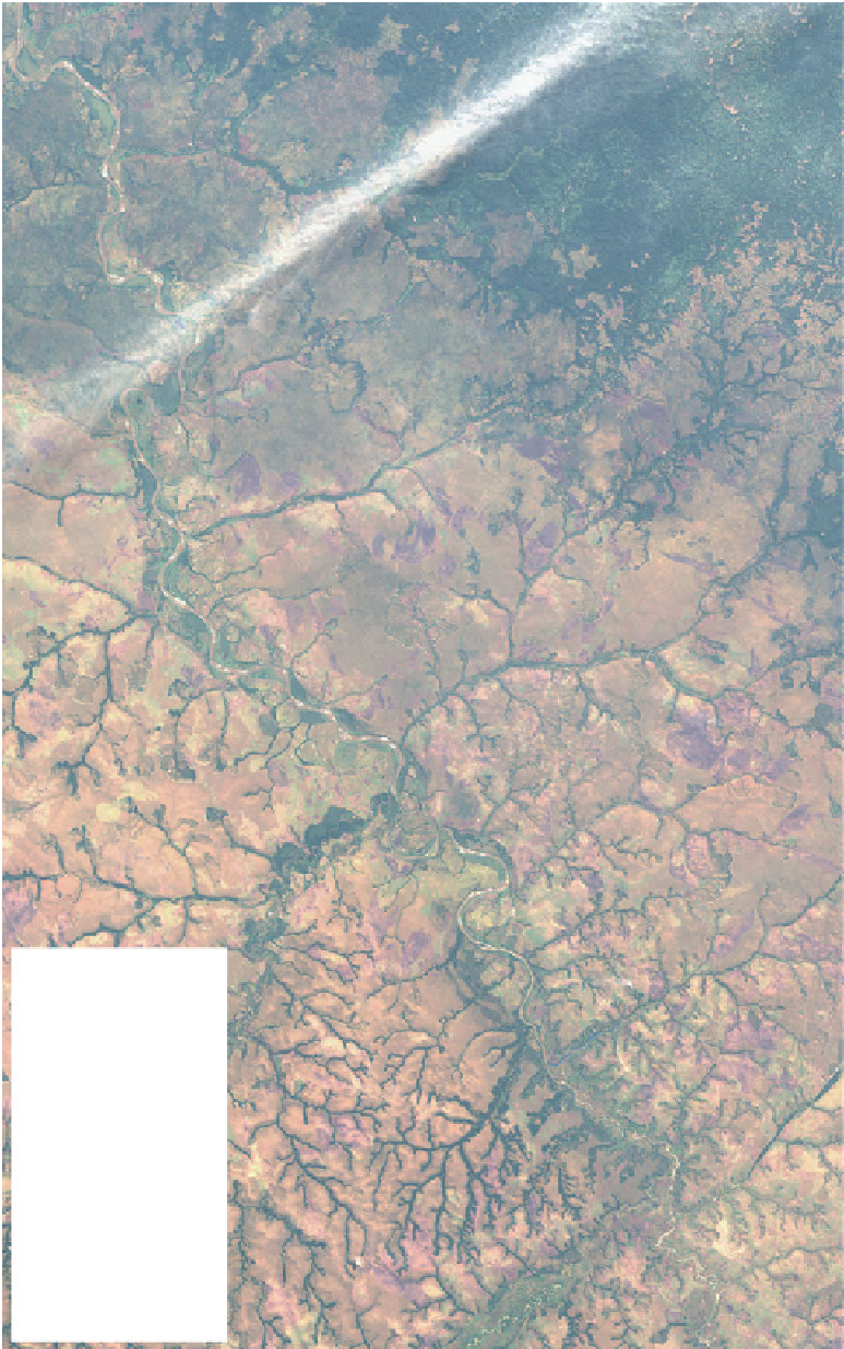
Fig. 8.3
Field study area along
the Kwango River, southwest
DRC (Fig.
8.1
for location), with
locations of investigated outcrops
(
WP
Waypoints; numbers in
red
)
and paleocurrent rose-diagrams
(number of measurements in
brackets
)
Mukenga
Kindamba
86
0
136
(13)
13
138
Mulundu Mission
(18)
TOTAL
Kitangu
Kasekenge
133
120
119
(4)
270
90
Mbomba
121
(1)
Kyienga
123
124
125
(3)
180
Kwango Group
(221 measurements)
Kimwambu
131
132
130
129
(7)
126
127
141
142
(6)
Menzelele
82
Mayala
78
77
Kizengamu
(32)
80
79
76
(16)
75
(22)
Fig. 4c
Swamasangu
152
73
72
(4)
164
(49)
165
97
Kabela
(11)
Fig. 4b
83
147
Mukelu
148
146
Legend :
132
Katembo
(2)
Outcrops (WP)
70
Artisanal digging
71
Nzasi-Muadi
Kafdoje
13
(21)
Stone tool
Matchacou
21
69
Kitsaku
64
56
Location
(5)
58
(5)
BRC Base Camp
57
Kahunza
Fig. 4a
Loboko-Zoba
City
160
20 Mai
Mission
TEMBO
Village
Port
Airport
Road
167
0
10
20
Km
(e.g. the Nsele Formation) more recent biostratigraphy
(Gobbo-Rodrigues et al.
2003
) indicates a Campanian-
Maastrichian age based on new correlations with
ostracods from Brazil (the Bauru Group). These
dates provide a maximum Late Cretaceous age for
the regional peneplanation surface that cuts across the
Kwango Group, and which defines the base of the
overlying (Cenozoic) Kalahari Group (Cahen and


Search WWH ::

Custom Search