Geology Reference
In-Depth Information
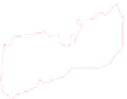
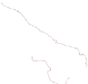
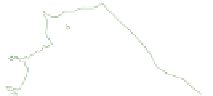
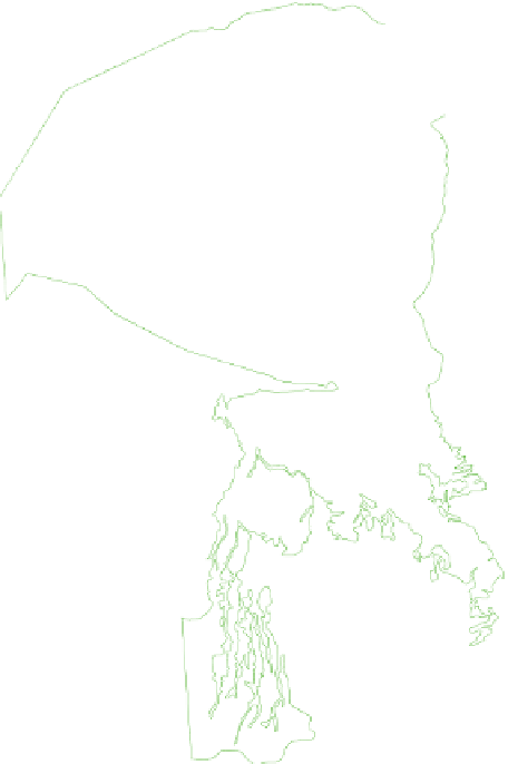
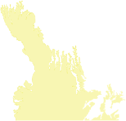
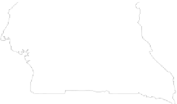
Fig. 8.1
Simplified geological map of the CB highlighting the J-K
sequences, with locations of the studied four deep boreholes and the
field area in the Kwango Valley (
red box
). This map was compiled from
the national geological maps of DRC (Lepersonne
1974
), Angola (de
Carvalho
1981
), Republic of Congo (Desthieux
1995
), and CAR (Rolin
1995
). Precambrian basement geology is from de Wit et al. (
1988
);
kimberlites are from Jelsma et al. (
2009
)
and significant erosion (de Wit et al.
2011
). All these J-K
sequences of the CB are here referred to as the Congo
Supergroup, as it represents a unique stratigraphic record
in sub-Saharan Africa and which can possibly be correlated
with other Mesozoic continental sections, such as in South
DRC (Fig.
8.1
for location), is generally subdivided into
two (Fig.
8.2a
):
1. A lower subgroup (equivalent to
1to8of
Cahen
1983b
), 50 m thick, comprises grey-green
carbonated sandstones and mudstones with black shales
and limestone intercalations.
2. An upper subgroup (equivalent to
'
Complexes
'
8to14of
Cahen
1983b
), about 320 m thick, comprises red-brown
mudstones alternating with sandstones. Its base is defined
by a thin and relatively continuous pebble-bed (Fig.
8.2a
).
Paleontological evidence from the Stanleyville Group,
essentially from non-marine ostracods, such as in particular
Praecypridea
cf.
acuticyatha
and
Theriosynoecum trinodasa
(e.g. Fig.
8.2b
; Grekoff
1957
; Colin
1994
) suggests a Late
'
Complexes
'
8.2.1 The Stanleyville Group
The lowermost, Stanleyville Group is a 400 m thick section
of fossiliferous sandstones and mudstones, mainly outcrop-
ping along the eastern margin of the CB (Cahen
1983b
). Its
type-section, at Kisangani (ex-Stanleyville) in northeast


Search WWH ::

Custom Search