Geology Reference
In-Depth Information
A
Bangui
YAOUNDE
Bondo
Bumba
Irumu
31
114
1
1
5
11
7
21
B
29
D
20
19
34
25
26
27
Kisangani
113
23A
18
40
35
17
109
33
Mbandaka
28
32
24
LIBREVILLE
30
4
112
16
Samba
1
37
8
36
22
110
10
12
15
108
111
14
11
C
38
13
106
39A
Walikale
107
41
104
42
Franceville
105
45
51
94
101
43
95
100
44
103
93
Gilson
49
50
46
Bukavu
90
99
52
97
57
102
56
7
1
47
98
92
55
91
53
73A
48
81
96
7
2
54
89
7
0
74
Kipala
69
58
65
88
60
BRAZZAVILLE
Seismic
stations
Dekese
75
62
73
64
80
85
86
85
77
63
76
59
KINSHASA
82
78
61
83
84
68
79
66
A
87
Glacial
paleo-flow
directions
67
Mbuji-Mayi
Matadi
Kalemi
Luk
uga River
Tshikapa
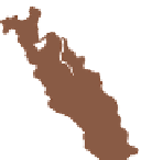
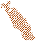
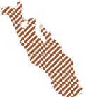
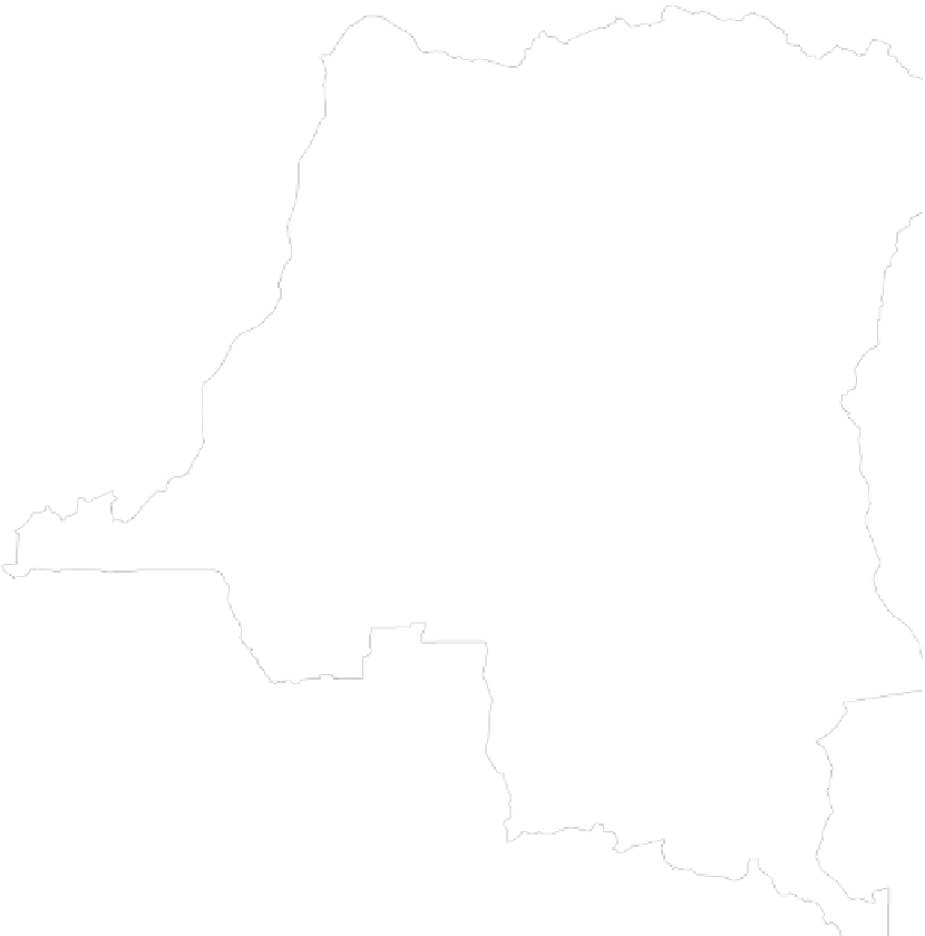
Fig. 3
KAROO OUTCROPS
Fig. 2B
Haute-Lueki Group
Lutoe Group
Lukuga Group
Tembo
Kamina
Lucapa
LUANDA
Malange
KAROO EXTENSION
IN SUBSURFACE
Lubumbashi
Haute Lueki Group
Lukuga Group
0
125
250
500
Km
Fig. 7.2
(continued)
comprise glacial and periglacial, fossiliferous deposits with
black shales that pass upward into arid continental sediments
(Cahen and Lepersonne
1978
; Cahen
1981
), tracking the
characteristic climatic evolution of central Gondwana during
the late Paleozoic and early Mesozoic (e.g. Veevers et al.
1994
; Milani and deWit
2008
). Similar Gondwana sequences,
in east Africa (in Kenya and Tanzania; e.g. Kreuser
1984
;
Wopfner and Diekmann
1996
), Madagascar (e.g.
Rakotosolofo et al.
1999
) and southern Africa (Johnson et al.
1996
,
2006
) are generally referred to as the Karoo Supergroup.
large west-facing paleo-glacial valleys (Fig.
7.2
). Other gla-
cial relics, also deposited with predominant paleocurrents
oriented to the west, are found sporadically along the south-
ern margin of the basin, in the Kasai and Kwango regions of
southern DRC and northern Angola (Asselberghs
1947
;
Lepersonne
1951
; Rocha-Campos
1976
), and along the
western and northern margins of the CB, in Gabon (the
Agoula Series; e.g. Mounguengui et al.
2002
) and Central
African Republic (CAR) (the Mambere Formation; e.g.
Rolin
1995
).
The type-section of the Lukuga Group in eastern DRC is
divided into two subgroups (Fig.
7.2B
):
1. The Lower Subgroup comprises two formations of
tillites:
7.2.1 The Lukuga Group
'
(Cahen and Lepersonne
1978
), separated by black shales.
It overlies a major unconformity on Precambrian
'
the lower and upper, mainly glacial beds
The Lukuga Group is between about 300 m and 600 m thick
along the eastern margin of the CB, best preserved within


Search WWH ::

Custom Search