Geography Reference
In-Depth Information
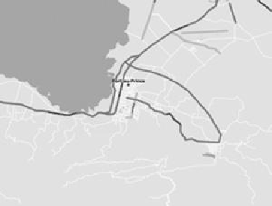
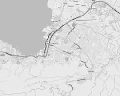
Port-au-Prince, as it looked in OpenStreetMap when the earthquake hit and the way it
looked a week later
After reading about the lives saved in Haiti by OpenStreetMap, I used it to look at my
ownneighborhoodandfoundthatthecul-de-sacweliveonwasalsomissingfromthemap.
After hesitating a moment—is it really okay to draw on a map?—I added and labeled my
street by hand, Wikipedia-style. It was a surprising rush to add something new, however
Cook charting the New Zealand coastline, a veritable Stanley of the suburbs.
Most of these new technologies are just reinventing how maps are made or the things
they can be used for, but one particular innovation is changing the very definition of what
a map
is
. “Augmented reality” is the practice of combining a real-world environment with
computer-generatedimagery,likethoseyellow“firstdown”linesthatappearanddisappear