Agriculture Reference
In-Depth Information
interval, is selected to best show the general shape of the terrain, includ-
ing prominent hydrologic features such as rivers and valley streams.
recoGnizinG Landform patternS
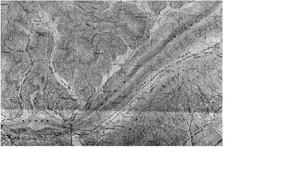
A topographic map is a representation of a small area of the earth's sur-
face. The distinctive characteristic of a topographic map—as opposed
to a treasure or city road map—is that the shape of the earth's surface
is shown by contour lines. Contours are a way of showing elevation and
landform graphically in two dimensions. Contour lines are derived from
points of equal elevation in the landscape. The shapes of the contours
convey to the viewer the sculptural form of the terrain. In Figure 5.4
contours were created using elevation data surveyed on the ground
in combination with aerial photography. Their elevation is based on a
reference surface, such as mean sea level. The reference information,
together with the date of the original or updated survey information, is
shown at the bottom of each USGS topographic map.
B
B
A
B
A
B
A
B
Figure 5.4
A variety of landforms found in the landscape as shown on a USGS topographic map