Agriculture Reference
In-Depth Information
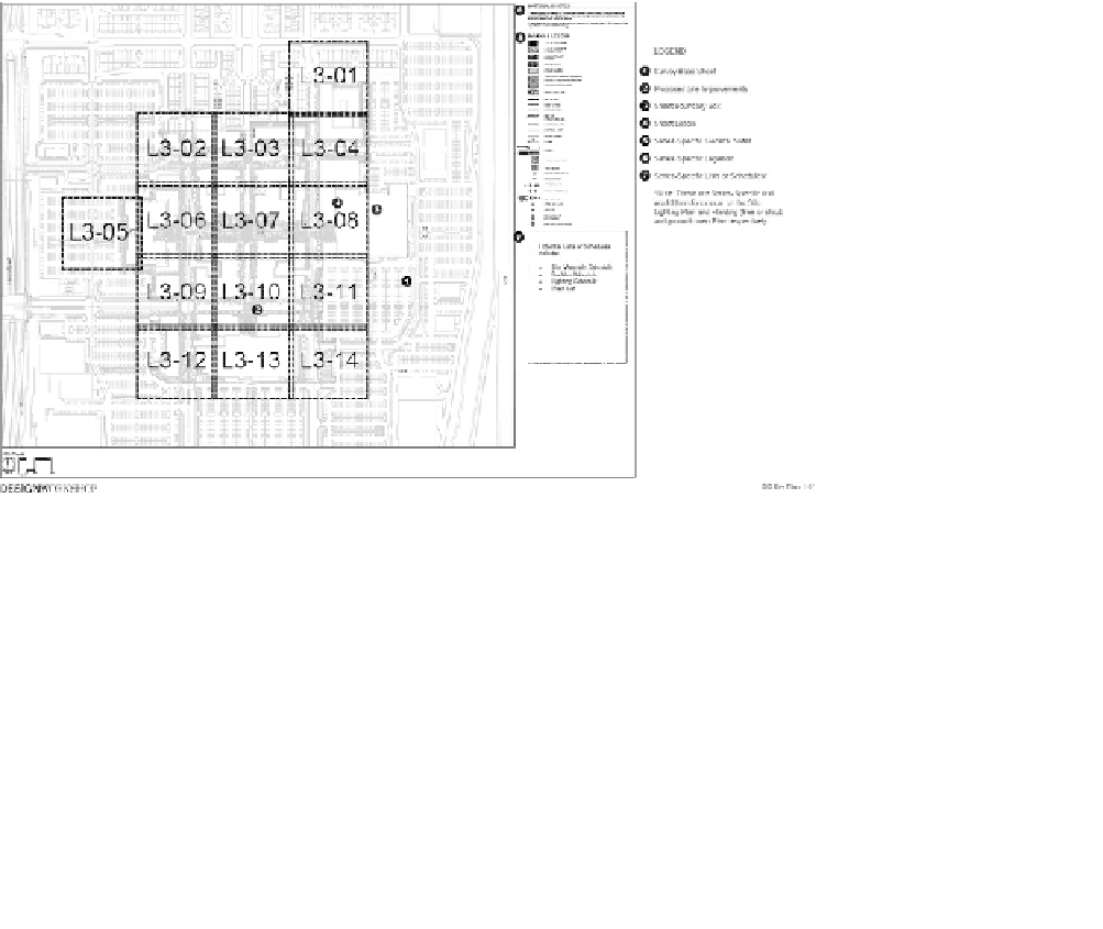
of match lines. While there might be some overlap of the sheets, this is
done to assist the contractor to coordinate the work shown in adjoining
sheets. A minimum of detailed information should be included within
the overlapping areas. It is advisable to avoid significant overlap to avoid
information conflicts or discrepancies. Each subplan is assigned a sheet
number (for instance L3-01). If the subject is landscape and the plan is
divided into five areas, then the subplans might be identified as Sheet
L-1 through L-5. If the subject is grading and the same subdivisions are
used as in the landscape plan, then the grading sheets might be identi-
fied as Sheet G-1 through G-5.
Figure 5.2
Sample plan with match lines as dark lines defining each plan sheet beginning with
sheet L3-01
Courtesy of desiGn Workshop, denVer, Co: dW doCuMentAtion: stAndArds And best prACtiCes, p. 61
Many areas have been mapped at different scales. The most import-
ant consideration in choosing a map is its intended use. A city public
works engineer, for instance, may need a very detailed map to locate pre-
cise sewer lines, power and water lines, and streets. A commonly used
scale for this purpose is 1:600, or one inch equals 600 inches (600˝ / 12˝ =
50 scale, where 1 inch on the map represents 50 feet on the ground). This