Agriculture Reference
In-Depth Information
rim elevation of the catch basin was established as the lowest elevation
within the grassy area.
Culvert
Under Walk
Walk
35
35
35
35
34
34
33
33
34
34
Catch Basin
Rim Elevation
31.8
Catch Basin
Rim Elevation
31.8
33
33
Figure 13.13- B
Step Two
Figure 13.13- C
Step Three
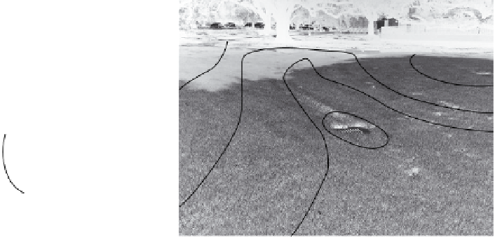
Step Three: Note the percent of slope indicated for the mounding
landforms. Note the culvert in the background to allow surface water
coming from the woodlot walk to flow under the walk (through a cul-
vert) to the lawn area.
ScuLpturaL Landform SoLutionS in LaWn
or LandScaped areaS
Figures 13.14-A and 13.14-B provide an example of a sculptural grad-
ing solution in a campus landscape. The photograph in Figure 13.14-A
was taken of a lawn area fronting a street that borders the campus. The
design intent was to provide visual interest and greater visual impact
for what could otherwise have been a simple level lawn area. The goals
of increasing visual impact and interest are achieved by the creation of
rolling mounds with gentle swales depicted as an oblique plan view in
Figure 13.14-B. In Figures 13.15-A and 13.15-B, the pedestrian walkway
system, with its gentle 1 and 2 percent slopes, traverses an adjoining land-
scape that has been sculpted with grass-covered mounds. The mounds