Agriculture Reference
In-Depth Information
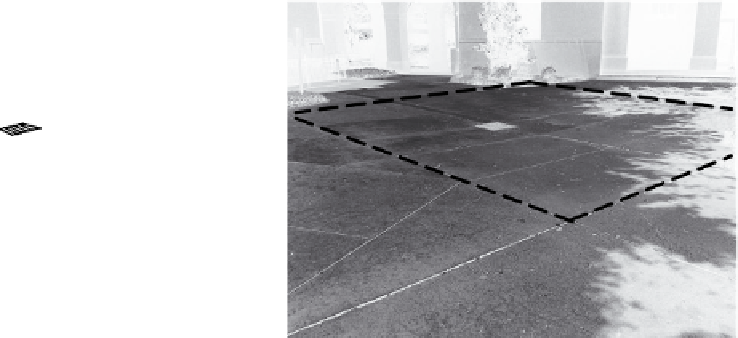
Figure 12.9-B was taken of an expanse of pavement within a larger cen-
tral campus quadrangle. The area outlined with a dashed line is in effect
a small watershed where any water that falls within the dashed area
flows toward a central point where a catch basin has been constructed.
The purpose of the catch basin is to carry the water underground in
pipes to a nearby storm water system (part of a city's storm water
infrastructure).
catch BaSin deSiGn in paved area
Once the designer has created a paved area, consideration will be given
to subdividing the area into smaller quadrants or watersheds to han-
dle surface drainage. By doing this, the designer creates the feeling of a
level, rather than sloping, paved area. The number and area dimensions
of quadrants can vary. See Figure 12.10-A.
The arrows in Figure 12.10-B indicate the desired surface flow of
storm water. The arrows within the dashed area show that water is
intended to flow toward a catch basin located in the center of the quad-
rant. The designer would establish an elevation for the perimeter that
would most likely be the same throughout the entire perimeter.
A
Perimeter
Elevation
Figure 12.10-a
Step One
Figure 12.10-B
Step Two