Agriculture Reference
In-Depth Information
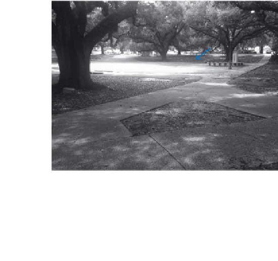
Stepping back 100 or so feet, we have a broader view of the context,
in Figure 11.14, with the same catch basin in the distance. In Figure 11.14
you can see the flow path of surface water shown as arrows directing
water to a catch basin located at the lowest elevation of the grass area
labelled. The landform created in the space creates a pleasant glade
surrounded by massive oak trees. The ground was shaped to direct
rainwater to the swale, and from there to the catch basin. The ground,
including the paved walkway, has been shaped with gradual slopes of
1 and 2 percent. The slope is adequate to direct excess water, while the
actual speed of flow is sufficiently slow to allow time for some of the
water to percolate into the soil deep below the surface and provide mois-
ture for the oak trees.
Figure 11.15 shows a drainage swale paralleling a roadway, and Fig-
ure 11.16 is a view taken 180 degrees toward a culvert looking along the
same swale further downstream. Notice that the slope of the swale was
3 percent in the first photograph and was made less steep as the swale
approached the culvert, to slow down the water. The uphill alignment of
contours shown in Figure 11.15 is a contour signature (more on contour
signatures to be covered in Chapter 12) that represents a drainage swale,
valley, ravine, gorge, or gulley on a topographic map.
Catch
Basin
34 .2
34
33
32
34
31
33
32
31
A
30. 6
Figure 11.14
Paths water flows across a landscape
Figure 11.15
A drainage swale collects and carries surface
water from the road and adjacent tree-covered slope