Agriculture Reference
In-Depth Information
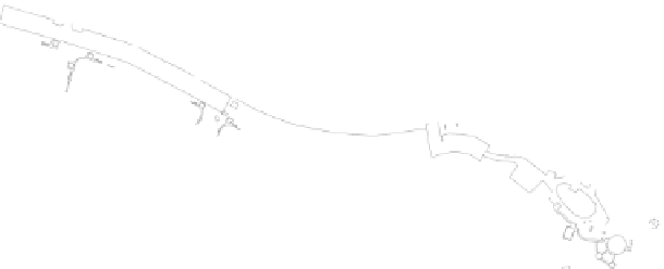
apart, we can see areas more suitable for grouping the buildings, park-
ing, and perhaps sport facilities. The existing central landform winding
horizontally across the map delineates upper and lower less steep areas,
suggesting perhaps the creation of two separate developments that
share the central more mountainous area. This central area could serve
valuable watershed management and greenbelt purposes, including
recreation.
35.9
34.6
35.3
35.3
36.1
34.5
34.8
35.1
36.8
36.0
36.1
34.5
33.6
34.0
35.7
36.2
50"
33.4
32.9
h-10
29.9
31.4
31.4
36.1
Te nnis Center
36.1
Te nnis Center
34.6
34.8
35.5
36.2
30.7
30.5
36.5
36.3
35.8
22.5
Playground
Courtyard
Courtyard
32.5
35.4
36.3
35.4
35.4
18.5
Fitness
36.4
32.7
34.6
33.1
36.0
GYM
Playground
18.4
36.1
34.5
awning
awning
33.5
Fitness Center
view
35.1
36.1
GYM
Volley Ball Courts
35.7
17.3
33.5
34.2
34.6
34.6
17.6
32.4
35.7
34.7
34.7
31.8
35.4
34.2
35.6
17.5
33.4
34.6
32.4
31.6
34.2
35.7
35.3
16.5
16.8
33.8
33.6
35.3
17.2
34.7
32.8
35.2
34.3
16.5
35.4
34.6
16.1
34.9
34.5
33.3
34.7
34.8
15.8
15.5
34.1
34.6
34.7
34.1
30
34.5
33.9
32.9
33.6
33.6
33.8
34.1
33.6
15.4
14.8
34.1
15.5
14.8
34.2
33.9
33.9
34.6
32.9
15.0
33.9
33.1
14.8
34.0
33.8
14.8
34.0
34.2
34.1
14.6
14.6
33.8
33.9
14.6
14.6
34.6
33.3
33.8
33.9
33.6
32.4
33.5
33.5
32.6
36.7
34.3
33.6
32.7
33.5
33.0
34.8
33.5
14.2
34.4
34.7
14.9
32.8
34.1
32.9
32.5
32.4
32.5
31.9
14.1
12.9
32.3
33.0
33.1
32.8
31.9
33.2
31.3
13.4
32.5
33.3
33.5
34.4
31.7
32.6
33.9
13.4
35.2
34.5
13.2
33.6
12.8
34.5
32.4
31.3
33.1
34.5
15.1
31.3
34.4
12.2
33.9
15.2
15.1
12.3
12.9
31.3
32.8
11.7
14.2
12.7
11.3
11.7
33.1
13.1
10.3
11.5
17.1
32.2
10.7
32.9
10.6
13.2
11.4
10.1
33.2
12.7
12.6
17.7
10.4
11.4
10.4
33.3
17.6
10.4
12.4
9.2
8.4
13.2
9.1
33.3
9.4
10.0
11.3
10.4
10.3
9.9
9.4
12.1
12.5
11.5
10.5
10.3
10.2
33.3
10.2
11.3
11.6
10.1
11.8
9.8
33.7
33.8
33.7
33.7
10.4
11.4
11.3
33.9
9.6
10.5
33.7
9.5
33.7
33.5
34.1
10.4
8.6
10.4
34.9
11.3
34.2
9.5
34.1
34.9
33.7
33.7
8.8
9.6
34.1
8.7
34.7
34.0
9.2
10.2
33.5
10.3
35.3
35.3
36.7
9.4
8.7
34.4
35.3
35.2
35.3
10.5
8.7
34.2
34.5
35.5
9.1
34.3
36.1
35.2
10.4
34.5
34.3
34.2
34.3
33.3
33.5
32.7
50'100'
00'
00'
00'
N
Figure 11.3
A topographic survey with contours reveals a diversity of landforms and suggests the
ideal locations for different program elements and circulation