Agriculture Reference
In-Depth Information
to create a variety of landforms is used to add a layer of physical and
visual challenge for a golfer approaching a hole. Manipulation of a proj-
ect's topography might be necessary to direct surface water off a sports
field or paved surface, or might be necessary to reduce the potential of
flooding a building. Site grading may include an earthwork strategy for
detaining surface water by creating a system of ponds and bioswales.
The experienced designer considers grading as a useful tool for achiev-
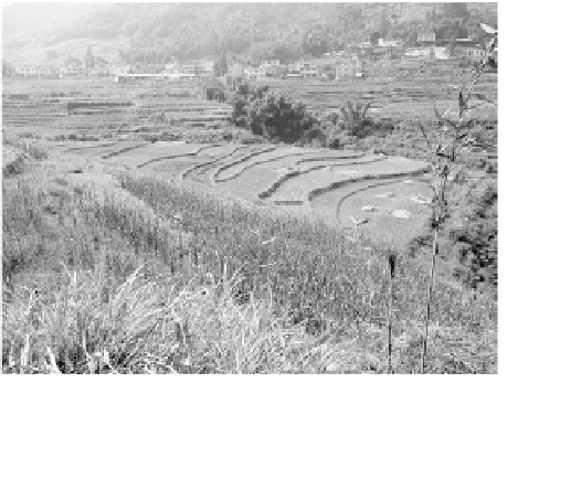
ing both functional and aesthetic objectives. So, where to begin? We
shall begin with the landscape itself. The scene in Figure 11.2 is a land-
scape, a rural agricultural landscape in central China.
If we had the task of designing, say, a cluster of cultural-tourism
cottages somewhere on these slopes, we would need at least two items,
before we should commence developing some preliminary ideas for the
project. First, we would need a scaled map showing property bound-
aries, and second, a topographic map comparable to the quad maps
available from the USGS. The Chinese equivalent to a USGS-type map is
useful for an initial site evaluation. In the case of a large tract of land,
this topographic map will help us identify the areas most suitable for
potential development and could be used as the basis of preparing a
preliminary master plan. At the outset of the site design phase, a more
precise topographic survey of the portion of the property to be designed
would be necessary. The survey would be done through the services of a
professional land surveyor.
The topographic survey of a site in
the USA might look like the one shown in
Figure 11.3. In studying the topography
in Figure 11.3, we are able to glean very
useful information to inform and inspire
our work. The contour lines that are close
together tell us the areas on the property
that are steep; in some cases they are too
steep for locating building clusters, and
perhaps too steep for an entry road, but
they may be perfect for a walking trail.
Where the contours are spread further
Figure 11.2
First start with the landscape