Agriculture Reference
In-Depth Information
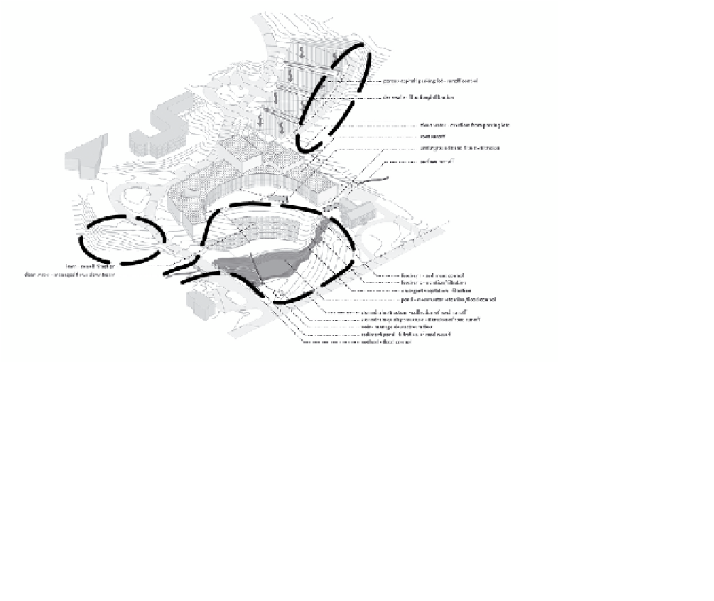
grading plan as a whole composition is the sum of its parts. The parts
compose the assemblage of a variety of contour patterns, resulting in
a cohesive site-grading plan. Figure 8.12 is a diagram—a three-dimen-
sional drawing—to help readers visualize the grading design and storm
water management concepts. Figure 8.13 is the actual site-grading
plan. Area A in Figure 8.12 is the application of the watershed landform
described earlier, used to create a storm water detention pond. The areas
outlined as B1 and B2 are sloping planes, area C is a swale, area D is a
driveway with a crown forming a concave landform, and areas E make
up a series of terraced parking lots with slightly sloping or tilted planes.
E
D
C
B
2
B
1
A
Figure 8.12
Storm water management concept, Hamilton College at College Hill Road
oriGinAl iMAGe proVided by reed hilderbrAnd AssoCiAtes
Putting all the landform tools together to create an aesthetically
inspired and functional grading plan is more than assembling a kit of
parts. A process for creating a grading plan is presented in Chapter 12.