Travel Reference
In-Depth Information
▲▲▲
Chapelle et Phare de la Garoupe
The territorial views—best in the morning, skippable if hazy—from this viewpoint more
than merit the 20-minute uphill climb from Plage de la Salis (a few blocks after
Maupassant Apartments, where the road curves left, follow signs and the rough, cobbled
CheminduCalvaireuptolighthousetower).Anorientationtableexplainsthatyoucansee
from Nice to Cannes and up to the Alps.
Getting There:
Take bus #2 or bus #14 to the Plage de la Salis stop and find the trail
a block ahead. By car or bike, follow signs for
Cap d'Antibes,
then look for
Chapelle et
Phare de la Garoupe
signs.
▲
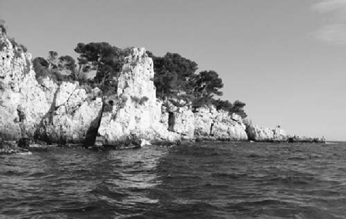
Cap d'Antibes Hike (Sentier Touristique Piétonnier de Tirepoil)
At the end of the mattress-ridden Plage de la Garoupe (over the hill from Phare de la
Garoupe lighthouse) lies a terrific trail around the tip of Cap d'Antibes. Use a map of
Antibes from the TI to track this trail. The beautiful path undulates above a splintered
coastline splashed by turquoise water and peppered with exclusive mansions. You'll walk
for about two miles, then head inland, hooking up with Avenue Mrs. L.D. Beaumont, end-
ing at the recommended Hôtel Beau-Site (and bus stop). You can walk as far as you'd like
and then double back, or do the whole loop (allow 3 hours at most). Bring good shoes, as
the walkway is uneven and slippery in places. Sundays are busiest.