Environmental Engineering Reference
In-Depth Information
were originally erupted. We follow that by de
ning plume generation zones
(PGZs) on the CMB and describe the role of deep mantle seismological data
sets in re
ning PGZ locations. The results of various reconstruction methods
are summarized and compared with several of the seismological data sets used
to define the edges of the LLSVPs and smaller LLSVPs (LSVPs) on the CMB.
Finally, we outline the evidence for the long-term stability of Tuzo and Jason.
3.2 Overview of LIPs of the past 300 Myr
LIPs (
Figure 3.1
) are areas of dominantly basaltic igneous rock mainly in
ows and
sills, and very large in volume (often 1
10
6
km
3
or more). They erupted in a very
short time (about 1 Myr or no more than a few million years at most) over an
extensive area (outcropping over about one million or more square kilometres)
but not over areas representing large fractions of the Earth
'
s surface such as those
that are occupied by the rocks making up the
floors of the oceans. The criterion of
eruption duration being limited to a short interval is the strongest in identifying
LIPs, although its application appears to require the availability of modern
high-resolution U
-
Pb age determination (see Bowring
et al
.,
this volume).
Alpha Ridge
NAIP
60°N
60°N
Siberian Traps
SCLIP
Columbia
River
Shatsky
Rise
Panjal Traps
Rajhmahal
30°N
30°N
CAMP
Emei
s
han
Emeishan
Emeishan
Hess
Rise
CCLIP
CCLIP
CCLIP
Deccan
Afar
Sierra Leone
Rise
Nauru
Magellan Rise
Manihiki Plateau.
Karroo
Ontong
Java
Wallaby Plateau
Parana-
Etendeka
Argo
Broken Ridge
Madagascar
Gascoyne
30°S
30°S
Agulhas Plateau
Bunbury
Central Kerguelen
Maud Rise
S
o
u
th Kerguelen
60°S
60°S
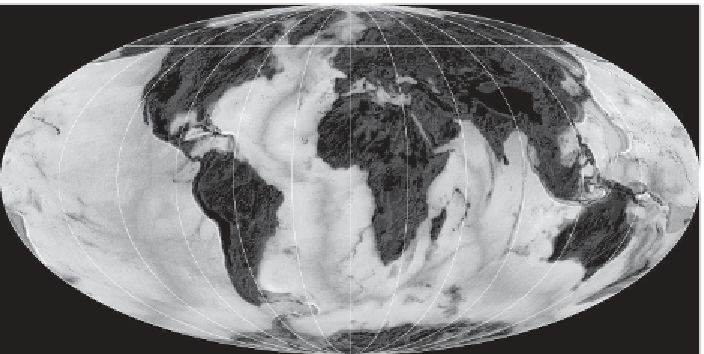
Figure 3.1 Thirty-one large igneous provinces (LIPs), 15 to 297 Myr old, and
their estimated eruption centres. One LIP is not reconstructed in this paper (CCLIP,
Caribbean Colombian LIP) because of reconstruction uncertainties and therefore
not listed in
Table 3.1
. The Panjal Traps are allochthonous and thus associated with
some reconstruction uncertainties in
Figure 3.2
. The Emeishan LIP has been
moved in longitude so that it falls above the western edge of Jason in
Figure 3.2
.
The areal extent of the Central Atlantic Magmatic Province (CAMP) is very liberal
in the inclusion of
c
. 201 Myr basalts, sills and dykes. Mollweide projection
(updated from Torsvik
et al
.,
2006
). A black and white version of this
figure will
appear in some formats.
For the colour version, please refer to the plate section
.