Environmental Engineering Reference
In-Depth Information
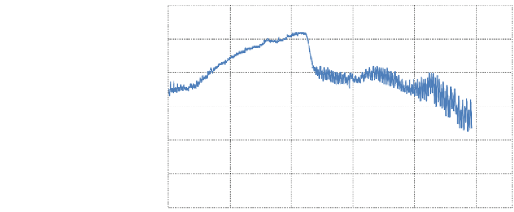
Fig. 6
Instantaneous data in
Diama and St. Louis (Quay)
before and after the opening of
the breach, between August 1st
and on 30 November 2003
(source data IRD)
2
Opening of the breach
Diam Aval (m IGN)
Saint - Louis (m IGN)
1,5
1
0,5
0
-0,5
-1
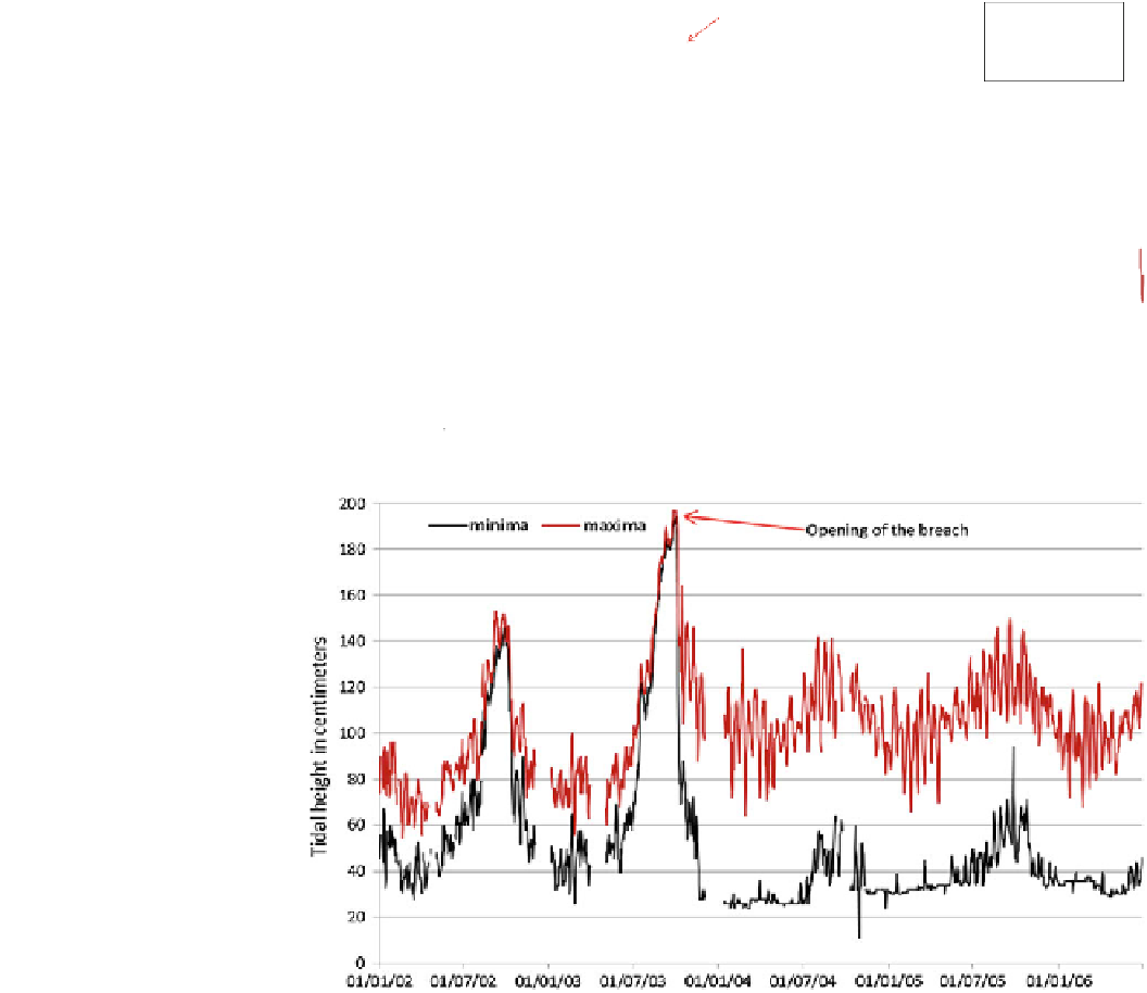
Fig. 7
Evolution of the tidal
range in St. Louis between 2002
and 2006
are often reported by the press. These could be related to the
strong turbulence of the water and the strong currents.
Since 1985, the hydrodynamics of the Senegal River
estuary has been under the double influence of the tide
during periods of low water and of the operations of
floodgates at Diama dam in times of flood. The tide in the
Senegal River estuary is semi-diurnal, with a period of 6 h.
Before the breach, the tidal range was attenuated by the
distance between the mouth and the town of St. Louis
(approximately 30 km); today an inversion of the situation is
seen, depending on the distance to the sea (approximately 7 km).
Since October 2003, the modifications of the tidal signal in
St. Louis have been one of the most remarkable consequences
of the opening of the breach (Fig.
7
). In the dry season, the
river follows the fluctuations of the oceanic tides. In periods
of low tide, the water level in St. Louis is close to -
0.44 m IGN; when the waters of the river are withdrawn and
one can see the piles below Pont Faidherbe (Photo
3
), a very
unusual sight for the population of St. Louis.
Examination of the tidal measurements for 2002-2006
highlights important changes: water heights recorded as
often for low as for high tides, indicate large tidal range
downstream of Diama, three times the previous level,
increasing from 0.30 m (average 2001-2002) to 0.93 m
(average 2004-2005) according to Kane et al. (2010). This
represents a major change in the hydrological functioning of
the lower estuary which is now under the almost exclusive
control of the tides.
The tides are now experienced all the year, even during
high waters of the Senegal River, contrasting with what was


Search WWH ::

Custom Search