Environmental Engineering Reference
In-Depth Information
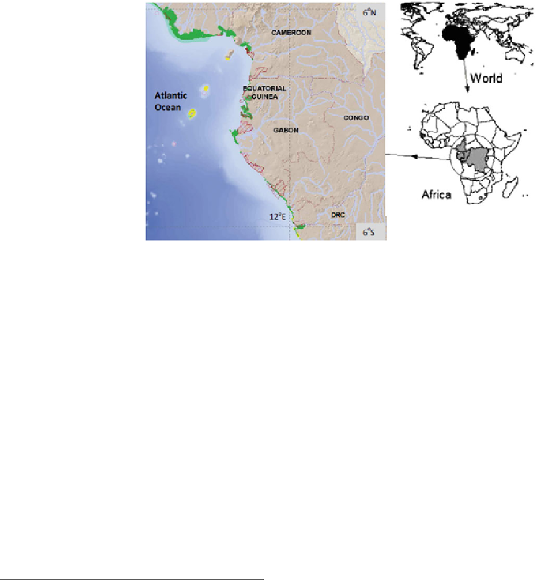
Fig. 1
Map showing the
location of selected mangrove
countries
Previously, no study existed in the Central Africa region
quantifying mangrove carbon stocks, sequestration rates
and possible emissions in response to their degradation. A
key challenge for successfully implementing any REDD+
Project is the reliable estimation of biomass carbon stocks
in forests. A reliable estimation of forest biomass has to take
account of spatial variability, forest allometry, wood density
and management regime. Many studies have been published
on aboveground carbon stocks in tropical forests around the
world (Komiyama et al.
2005
), but limited studies exist on
belowground root biomass and soil carbon. Knowledge is
even more limited for mangroves, where localized allome-
tric equations for different mangrove species are limited.
This chapter presents results of field assessment in the
four selected countries in Central Africa, including: Cam-
eroon, Gabon, RoC and DRC, which together account for
90 % of mangroves in Central Africa. The information can
serve as a contribution to further improve our global
understanding of the climate change mitigation potential of
mangroves and a basis to establish initial baselines in future
mangrove projects and REDD+ strategies in Central Africa.
Cameroon and Gabon take part in the World Bank Forest
Carbon Partnership and have the highest mangrove covers
in Central Africa. The following general criteria were used
in selecting study sites:
• the forest structure and composition appear to be typical
of other sites in the region,
• waterways and canals are reasonably navigable even
during low tides to allow for access and transportation of
equipment and materials,
• different forest conditions are represented,
• the area is not so readily accessible that sample plots may
be illegally felled.
Biophysical Characteristics
A variety of habitat types (coastal lagoons, rocky shores,
sandy beaches, mudflats, etc.) characterize the Central
African coastline with a vast array of rivers flowing from the
hinterlands into the Atlantic Ocean. The confluences of these
rivers with marine waters form suitable conditions for the
development of outstanding giant mangrove vegetation in the
region that also harbours the world's second largest tropical
rainforest. The climate in Central Africa is mainly equatorial
characterized by abundant rains (3,000-4,000 mm in Cam-
eroon, 2,500-3,000 mm in Gabon and RoC and 772 mm in
DRC) and generally high temperatures with monthly average
of 24-29 C, with a dry season spanning November to March
in Cameroon and June to October in DRC. A typical climate
diagram in Central Africa (Cameroon) is given in Fig.
2
.
September is normally the month with the highest rainfall,
while December has the least.
Study Approach and Methodology
Descriptions of Project Area
Four pilot areas in Central Africa were selected for the
study, including Cameroon, Gabon, DRC and RoC (Fig.
1
;
Table
1
). Collectively, these pilot countries contain 90 % of
mangroves in Central Africa. Further, DRC and the RoC are
part
of
the
UN-REDD
programme
countries;
while
Search WWH ::

Custom Search