Environmental Engineering Reference
In-Depth Information
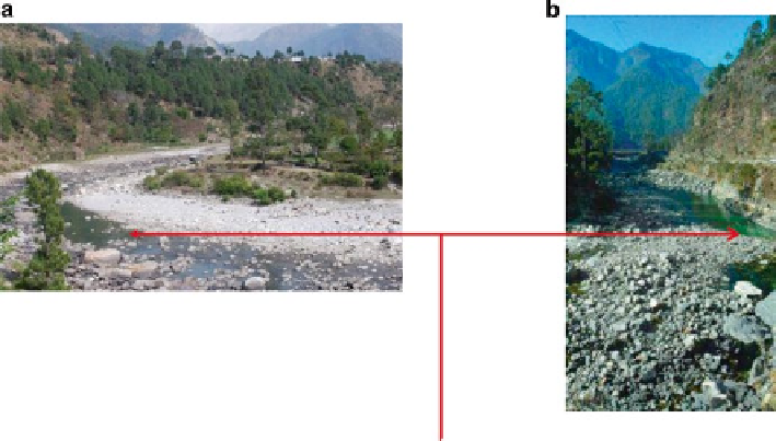
Fig. 2
Severely reduced water levels during winters. (
a
) Reduced water levels after Maneri
Bhali - Phase II, Location village Barethi. This site is approximately 5 km downstream from
Uttarkashi where Phase II project dam wall is located. (
b
) Reduced water levels after Maneri
Bhali - Phase I, Location near village Gangori. This site is approximately 3 km down-streams
from the dam wall of Maneri Bhali - Phase I, project site
Field Methodology
Field methodology included sampling for fishes, collection of zoo-planktons, phyto-
planktons and measurement of physico-chemical parameters of water.
Zoo-planktons
Samples were collected using plankton net and preserved. A quadrate of 1 m × 1 m
was marked and the collection was made from these quadrates. These samples were
photographed and identified using existing zoo-plankton key of Needham and
Needham (
1962
).
Phyto-planktons
Plankton-net method was used for this sampling. Amount of water to be filtered for
collection of phyto-planktons was standardized. Five volumes of a 5 L capacity
bucket were filtered for each collection from specific study sites. The collected sam-
ples were preserved in 4 % formalin. The samples were identified using the key of
Needham and Needham (
1962
) and their numbers were counted using Sedgwick-
Rafter slide.
Search WWH ::

Custom Search