Environmental Engineering Reference
In-Depth Information
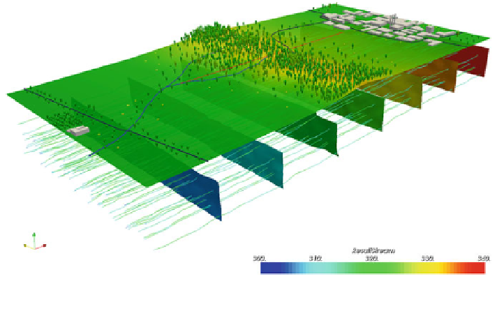
together with Layerscape (Microsoft Research
2013
), Paraview (Fig.
7
), and
GeoZui4D (
http://vislab-ccom.unh.edu/GeoZui4D/
)
. These tools allow for the
creation of more or less interactive 3D movies that illustrate fluxes (4D as exem-
pli
ed in Fig.
7
).
Modern geospatial visualization techniques for system understanding that is
appropriate for decision-makers should make use of the completely automatic
infrastructure that goes the complete distance from data to interactive visualization.
Therefore, such a framework should allow that the included model is fed by data
that can be continuously added manually or automatically by sensors or mobile
phone data. The model should then automatically, with very low supervision and
user inspection, simulate the processes of interest. The complete workflow from
data to visualization can be represented by virtual geographic environments (VGE).
VGE are computer- and often web-based geographic information systems (Lin et al.
2013
). As a further development of geographic information systems (GIS), VGE
generally comprises four components: data, modelling and simulation, interactivity,
and a collaborative component (Lin et al.
2013
). This platform is designed to
provide to the users a systematic analysis of processes with a real world experience
feeling (Lin et al.
2013
). The VGE approach considers the proposed workflow from
data to visualization shown in Fig.
1
. The data is stored in geographic databases and
is connected to the modelling component of the VGE system. The several types of
data products (geospatial images, tables, structural objects) need to be jointly stored
and transformed for integrative use. This is often needed to meet the data format
requirements of the applied model or to visualize the model products making them
available through the internet [e.g. by GIS, GeoServer (geoserver.org)]. This
integrated and modular VGE system allows additionally for the simulation and
Fig. 7 3D
4D visualization of GRASS GIS voxels of groundwater flow with Paraview.
Source
GRASS GIS
http://grass.osgeo.org/screenshots/3D/
(screenshot: S
-
ö
ren Gebbert)
Search WWH ::

Custom Search