Geoscience Reference
In-Depth Information
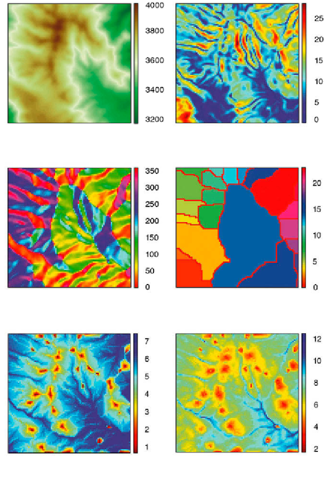
a
b
c
d
d
e
Fig. 7.15
Display of a subset of the SRTM data set used in Section 7.5 and primary and
secondary attributes of the digital elevation model;
a
elevation,
b
slope,
c
aspect,
d
watershed,
e
l ow accumulation, and
f
wetness index (data from Farr et al. 2000, 2008).