Geoscience Reference
In-Depth Information
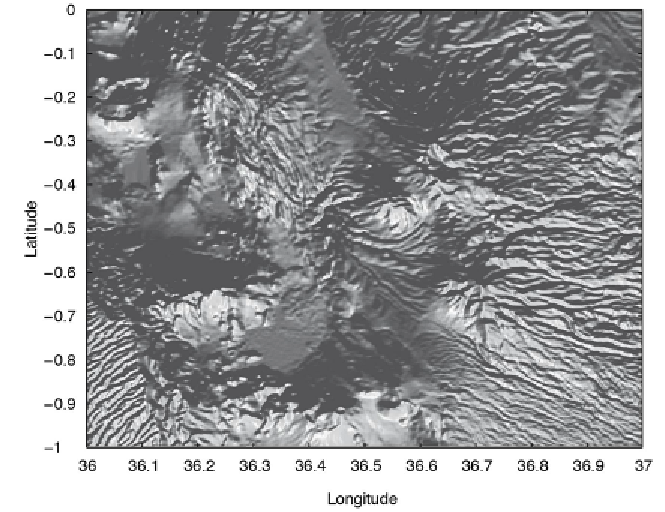
Fig. 7.4
Display from the i ltered SRTM elevation data set. h e map uses the function
surfl
to generate a shaded-relief map with simulated lighting, using interpolated shading and a gray
colormap, displayed in an overhead view (data from Farr et al. 2000, 2008).
7.6 Exporting 3D Graphics to Create Interactive Documents
Since the introduction of electronic devices with touch controls, interactive 3D
graphics objects have become increasingly popular in multimedia electronic
topics (
ebooks
). h e Simulink 3D Animation available from h e MathWorks,
Inc. provides the necessary tools to create and export 3D graphics objects for
inclusion in documents such as multimedia ebooks, interactive webpages,
and presentations (MathWorks 2014b). h e VRML i les are text i les with the
i le extension
.wrl
for
world
, short for
Virtual Reality World
. Opening such
a i le in, for example, the MATLAB editor reveals that it contains vertices
and edges for 3D polygons, together with parameters such as surface colors,
textures, transparency and so on. h e VRML i les can be viewed using a
browser plugin (of which there are many dif erent types available online), or
using 3D sot ware such as the open-source
MeshLab
sot ware
http://meshlab.sourceforge.net