Graphics Reference
In-Depth Information
deceased providedthe insight forhisconclusionthat thesourceoftheoutbreak could
be localized to contaminated water from a pump on Broad Street, the founding in-
novation for modern epidemiological mapping.
Scales and shapes for graphs and maps were also transformed for a variety of
purposes, leading to semi-logarithmic graphs (Jevons,
,
) to show percent-
age change in commodities over time, log-log plots to show multiplicative relations,
anamorphic maps by Émile Cheysson (Palsky,
, Figs.
-
) using deforma-
tions of spatial size to show a quantitative variable (e.g. the decrease in time to travel
from Paris to various places in France over
years) and alignment diagrams or
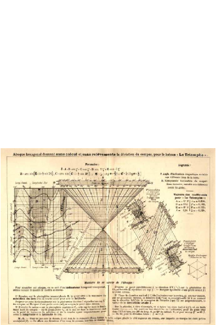
nomograms using sets of parallel axes. Weillustrate this slice of the Golden Age with
Fig.
.
,atour-de-forcegraphicfordetermination ofmagnetic deviation at seainre-
lationtolatitudeandlongitudewithoutcalculation('L'AbaqueTriomphe')byCharles
Lallemand(
),directorgeneralofthegeodeticmeasurementofaltitudesthrough-
out France, which combines many variables into a multifunction nomogram, using
-D, juxtaposition of anamorphic maps, parallel coordinates and hexagonal grids.
Figure
.
.
Lallemand's L' abaque du bateau “Le Triomphe”, allowing determination of magnetic
deviation at sea without calculation. Source: courtesy Mme Marie-Noëlle Maisonneuve, Les fonds
anciens de la bibliothèque de l'École des Mines de Paris