Travel Reference
In-Depth Information
From the north end of
Carmel River State Beach,
the hike strikes out across sand
and heads southwest toward the river mouth. Sand bridges the river mouth in summer,
but expect a wet crossing after winter rains. If you prefer to keep your feet dry, park
at Monastery Beach and hike north, following this trail description in reverse. Park-
ing stretches for 0.2 mile along Highway 1 at Monastery. Just south of the lagoon you
can either continue along the shoreline or climb atop the bluffs for sweeping views of
Carmel Bay, the lagoon, and the marsh.
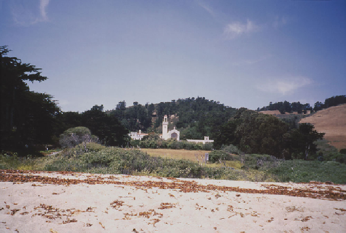
Monastery Beach offers views inland that give rise to its name.
The bluff trail leads up a half dozen stairs to a fork (0.2 mile, 25'). The left spur
traverses the east edge of the bluff for views of the marsh and lagoon. This spur then
turns south through thickets of coyote brush, sagebrush, and lupine, ascending a small
knoll capped by a large
wooden cross
(0.3 mile, 35'). A plaque explains its signi-
ficance. In 1769 the Portolá-Crespi expedition traveled overland from Mexico. After
waiting in vain for the long-overdue supply ship
San Jose
, they erected a cross here to
signal their early return to San Diego. From here the spur veers west and rejoins the
main bluff trail.