Biology Reference
In-Depth Information
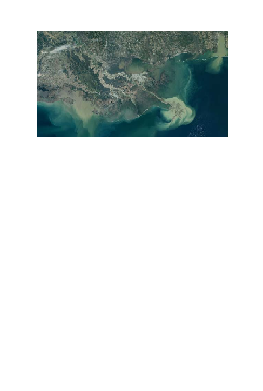
nation's interior out into the sea. Only in San Francisco Bay did the power of flow-
ing river water and rising seas cut gaps in the hard rock of coastal ridges. (NASA
Goddard Space Flight Center)
the water gets deeper and faster; at each opening it shallows, slows, and
warms.
“It's a really weird estuary,” says Herbold. “These two rivers cut down
and form a big delta, and then they come back together into one little
bottleneck out into the bay. Shapewise from the air, it looks like it should
be flowing the other way.”
The forces that created the estuary's unusual geography thrust moun-
tains up from the seafloor and warmed or cooled the climate enough to
cause a change in sea level. The estuary has only been around for about
5,000 years in its current shape. But geologists trace the building blocks
back much further. Rock and soil profiles under the bay and in the coastal
cliffs reveal at least three periods during which the sea level rose and fell
across the landscape in step with glacial changes over the past million
years. The most recent rise occurred about 15,000 to 18,000 years ago. At
that time, Pacific waves didn't crash as far east as they do today. The shore
extended out to the rocks of the Farallon Islands, and river waters empty-
ing out of the valley and through the Carquinez and Golden Gate straits
still had 20 miles to go west of today's gate before meeting the sea.
Geologist Doris Sloan paints a picture of this time in
Geology of the San
Francisco Bay Region
: “On a sunny weekend you could have hiked out
across the broad, gently sloping continental shelf for a picnic on the Faral-
lon Ridge overlooking the Pacific Ocean to the west. Or you could have
stood on the headlands above the Golden Gate and watched the mighty
flow of the river as it poured through the valley, tumbling over great cas-