Biology Reference
In-Depth Information
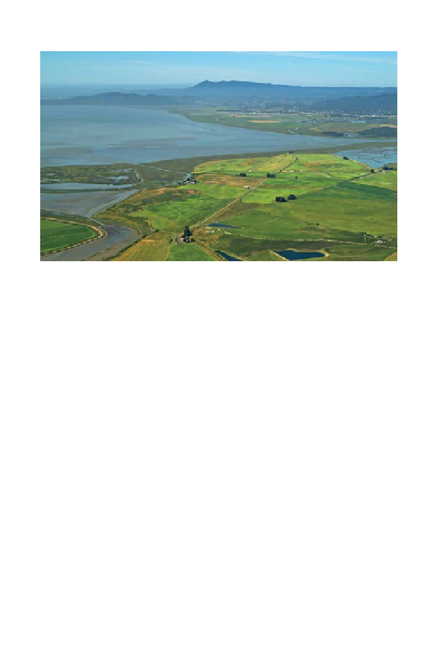
San Pablo Bay's northern shoreline: in the foreground, from left to right are Tolay
Creek, Tubbs Island, Sears Point, Sonoma Baylands, and the Petaluma River. The
Sonoma Land Trust will restore nearly 1,000 acres of Sears Point to tidal marsh
beginning in 2012. (Stephen Joseph, courtesy of the Sonoma Land Trust)
wetland, one that visitors can walk and bike around all the way to Tolay
Creek on the Bay Trail.
The Bay Trail will also run past the old Clementino dairy farm at Sears
Point, where locals and feds have teamed up to create a new wildlife refuge
and land trust headquarters. The site both preserves the farm buildings
and cattle that graze the surrounding fields, and offers visitors a window
into the complexity of the wetland ecosystem. “People relate more easily to
the farm culture than they do the wild. When they come to the baylands,
they're often not sure what to do, or how to be here,” says Christy Smith.
“At the refuge, we can connect them to both, give them a sense of belong-
ing to nature right in their backyard.”
The only place visitors could connect with these baylands before this
new hub came into being was Tubbs Island. The island lies midway across
Highway 37, and for a long time it was the only place on the North Bay
shore offering picnic tables, interpretive displays, bathrooms, and sign-
posted trails.
Beyond Tubbs and the roar of the Infineon Raceway, Highway 37
crosses Sonoma Creek, and there's a clear view through the refuge marshes
all the way out to the open waters of the bay. To the north stretches Skaggs
Island, once a top-secret communications center for the navy. The restora-
tion fate of this fallow farm, added to the wildlife refuge in the 1990s, is