Graphics Programs Reference
In-Depth Information
Finally, this “decompartmentalized” use of software in a dynamic, collabora-
tive pipeline (SketchUp, Vray, Artlantis, Photoshop, Internet, etc.) and the
exchange of data in various formats represent an original and efficient
approach.
To illustrate this, we are going to look at three distinct cases: three images
generated from the project. They were not intended to convey the same
information and would, therefore, be produced using different methods.
Nevertheless, they were all created from the same 3D model that formed the
basis of the project.
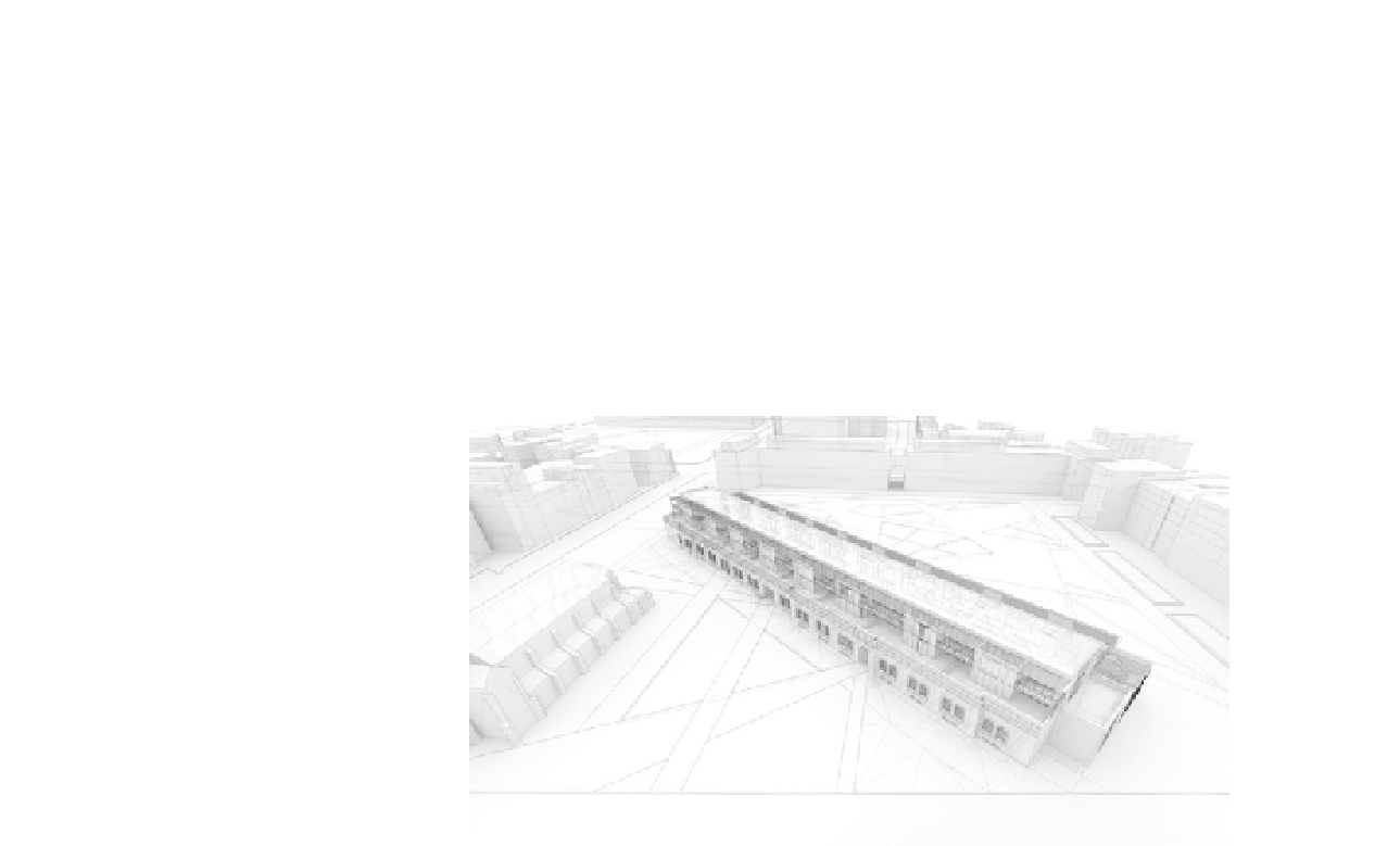
FiG 1.1
Model of project.
An Aerial View
Presenting the building in its entirety, showing its relationship with the urban
fabric, entailed the creation of an overall view that summed up the intentions
and the impact of the project.
Stage 1: Define a Composition
Objectives
: Make choices that optimize how the image will be read.
Data
: 3D model.
Tools
: SketchUp and Vray.
Here, we tried to get over a notion of the hierarchy of the elements shown, in
order to stress the major points of the project in relation to its environment.
To do this, the urban context was modeled entirely of schematic blocks ren-
dered in “clay render” mode. The easiest way of achieving this is to choose an
appropriate preset within Vray: In Vray's options, click on File > Load, choose a
preset (the file extension is .visopt) and start the render.
Thanks to this approach, it was easy to see the scale and relation of the princi-
pal elements, without overburdening the image with graphic information.
Search WWH ::

Custom Search