Graphics Programs Reference
In-Depth Information
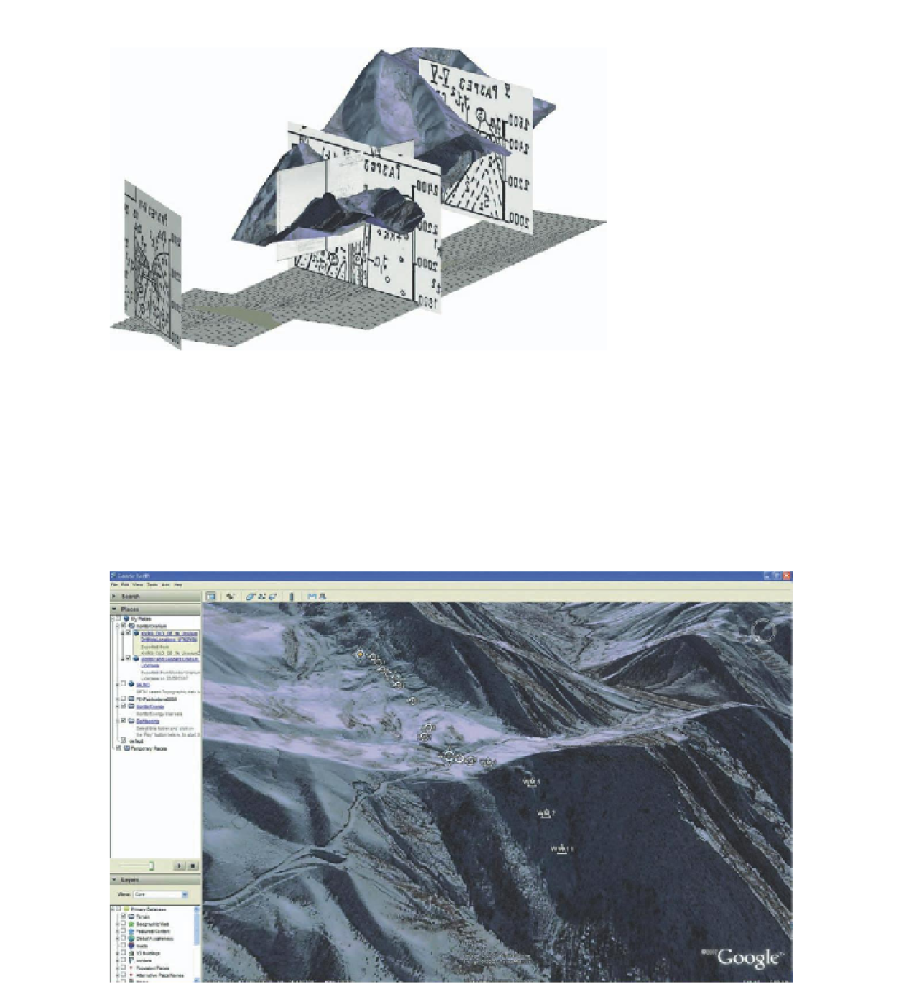
FiG 15.19
A field trip to Kyrgyzstan with global position sensors (GPSs) identified key
features of the abandoned mine, including cemented-up shafts and open
adits (mine drains). I exported the GPS locations to Google Earth to validate
the adits with the topography. I then shifted the ArcGIS map and SketchUp
model to match the GPS locations using the MoveIt.rb plug-in, which con-
firmed beyond doubt that the mine plans and sections belonged to the
abandoned mine
FiG 15.20
Search WWH ::

Custom Search