Graphics Programs Reference
In-Depth Information
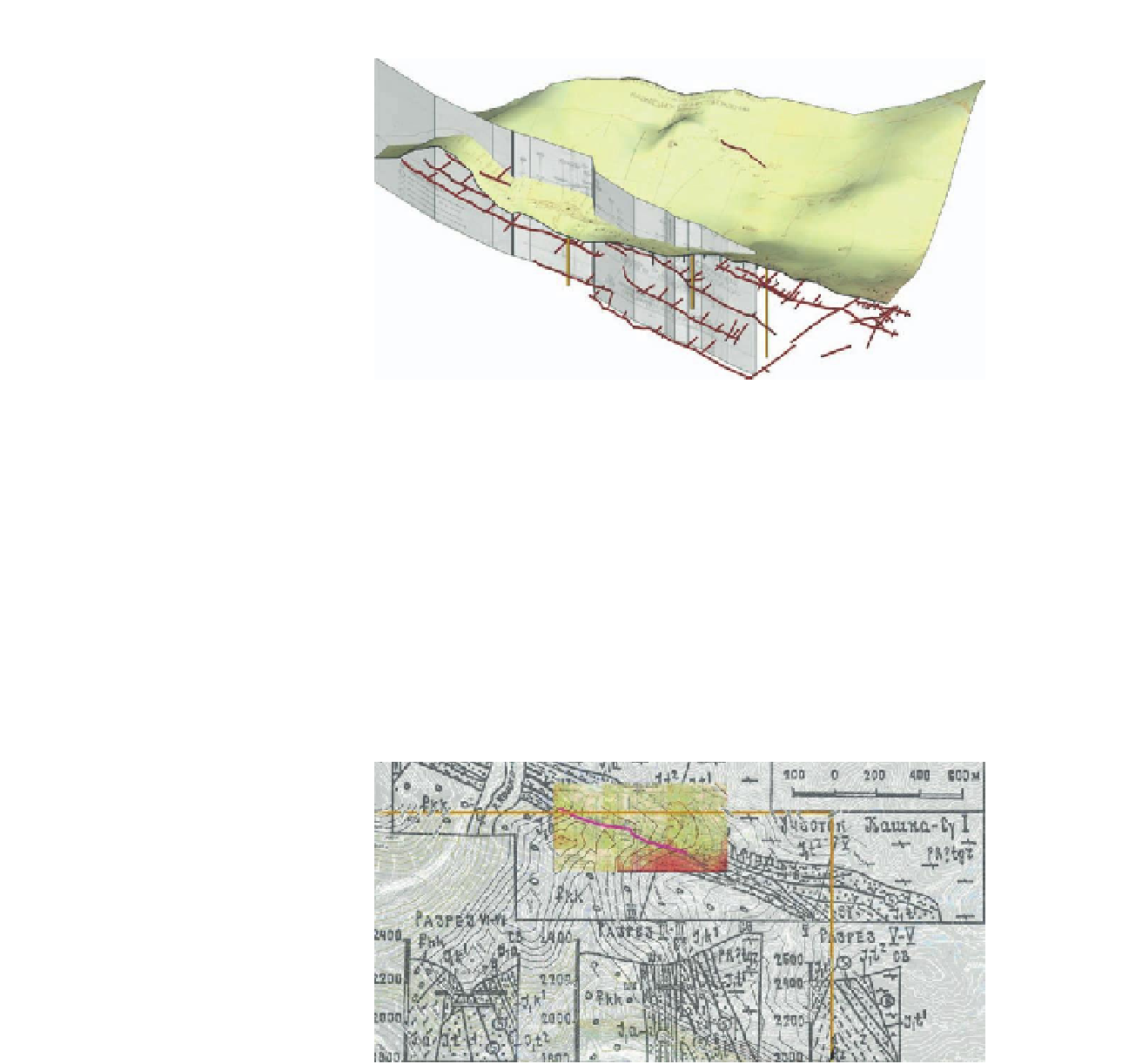
FiG 15.17
Step 10: ArcGIS Export to SketchUp
Goals
: To export the ArcGIS features, georeferenced maps, and sections
into SketchUp.
Inputs
: ArcGIS points, lines, and scanned sections.
Tools
: ArcGIS, Cloud6 plug-in, and ArcGIS SketchUp plug-in.
First I use ArcGIS to create a vector map of the scanned Russian maps, includ-
ing the point locations of mine shafts, mine adits and lines for contours, and
mine tunnels to produce a map of the area. The SRTM data were imported
into SketchUp using the cloud6.rb script, and the Google Earth image was
used as a material to color the surface. The mine plans and section locations
were adjusted to provide a good fit with the SRTM model.
FiG 15.18
Step 11: GPS Validation
Goal
: To validate abandoned mine site with GPS.
Inputs
: GPS Locations of the mine site.
Tools
: GPS, ArcGIS, and Google Earth.
Search WWH ::

Custom Search