Graphics Programs Reference
In-Depth Information
(http://www.gsd.harvard.edu/gis/manual/arcgis2sku_fp/index.htm) and is
not repeated here. In June 2007, Google released a Beta ArcGIS 9.2/SketchUp
6 Pro importer/exporter (http://sketchup.google.com/download/plugins.
html#arcgis) that supported the import of multiple selected 2D and 3D
features from an ArcGIS map document and the import of TINs from ArcGIS
ArcScene. This beta script appears to work with SketchUp 7, with the following
major limitation: SketchUp fails to place the imported features at the correct
real-world location in an existing model. The imported features would instead
be centered from the maximum extent of the imported feature classes. The
fundamental problem is the site-centered nature of SketchUp, which requires
a model to have a center location with a WGS84 latitude and longitude and
zero elevation. My solution was to select the site center at a known latitude
and longitude and to create a feature class that extends equidistant in the
X and Y axes beyond the extents of other feature classes.
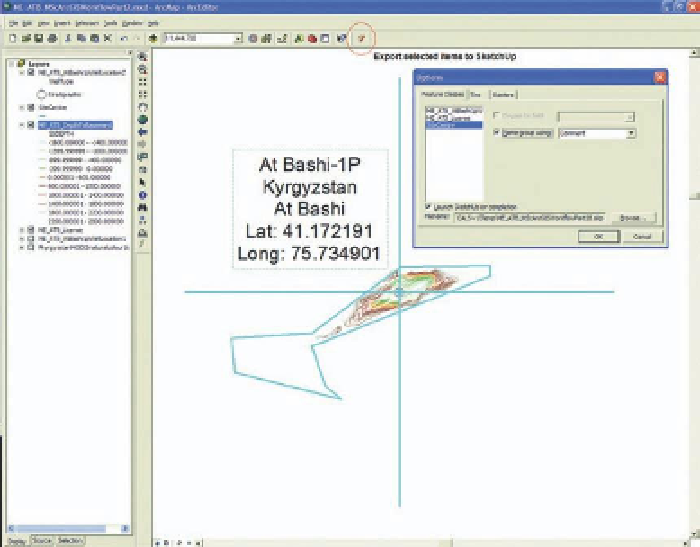
Importing the site center feature class (shown in blue), with any import,
ensures the model data remain correctly georeferenced.
Using the ArcGIS plug-in, a point, line, or polygon feature class can be exported
from ArcGIS to SketchUp with an elevation z. The selected features at WGS84
X, Y, and Z locations are exported from ArcGIS with options for elevate by field
and naming of groups. This method is satisfactory, but has limitations including
the inability to import 2D point feature classes. It is recommended for detailed
information that point and polygon features are converted into 3D features
prior to export. An excellent set of 2D to 3D tools is contained within the ET
Geowizards plug-in for ArcGIS, which can save the cost of ArcGIS 3D Analyst.
FiG 15.12

Search WWH ::

Custom Search