Agriculture Reference
In-Depth Information
a
Yield t/ha
<2.5
2.5-5.7
5.7-7.6
7.6-8.9
8.9-15.2
0 50 100
200 Meters
b
NDVI
0.89
0.16
0 50100
200 Meters
c
RATE
Low
Moderate
High
Ext. high
0 50 100
200 Meters
d
Yield t/ha
<2.5
2.5-5.7
5.7-7.6
7.6-8.9
8.9-15.2
0 50 100
200 Meters
e
NDVI
0.84
0.19
050
100 200 Meters
f
Zone
1
2
3
4
5
6
0 50 100 200 Meters
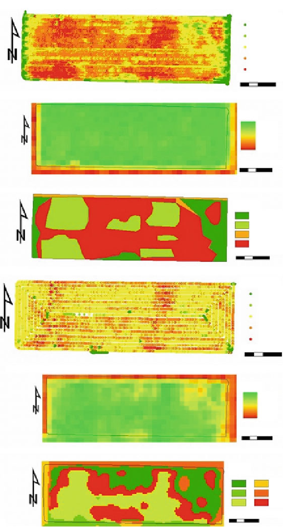
Fig. 4.3
An example of remote sensing application for precision agriculture. (
a
) Historical yield
map of corn in 2003. (
b
) NDVI map by Landsat of 2004. (
c
) Zone map of variable-rate fertilizer
application. (
d
) Improved resulting yield in 2005. (
e
) Corresponding NDVI map by Landsat of
Search WWH ::

Custom Search