Geoscience Reference
In-Depth Information
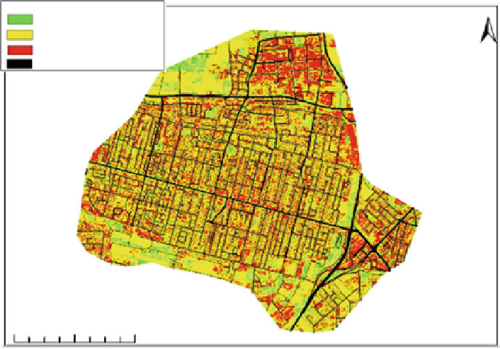
Legend
N
Vegetation Cover
Open Area (Soil)
Impervious area
Roads
0
375
750
1,500 Meters
Fig. 5.2 RGB un supervise and supervise classification
Guided classification of the nine-channel multi-spectral images make it possible
for characterizing land use by means of spectral signatures identification of the
principal classification categories. Since the pixel area in the sampling reaches
225 m
2
. it is not possible to calculate the exact area and extent of the land use as
in the guided classification of the orthophotograph and hyperspectral sampling.
Therefore the classification will be a source for comparison with the results of
other classifications such as guided classification according to the orthophotograph
(Fig.
5.3
).
5.2.5 Hyperspectral Classification
A guided classification of 198-channel hyperspectral images (AISA) provides
a great deal of precision in the characterizationoflanduseandtheirdistribution
into categories and subcategories; the classification makes it possible to find
the extent and size of the land useland use in the imaging process. Since the
hyperspectral imaging is limited to the narrow area of the study, it is not possible
to carry out a guided classification based on the hyperspectral imaging for
the study entire area (Fig.
5.4
). The buildings, roads, drainage net, were taken
from the national Israeli GIS system. These data were also integrated in
analyzing the land-use classification comparison and verification.