Geoscience Reference
In-Depth Information
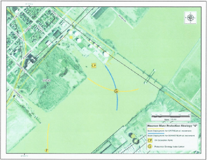
Fig. 11.4 Example of a river boom protection strategy
and Coast Guard District or US EPA Region number if appropriate. This information
will be on the sheet with the strategy name; it will also be on the right edge of the
previous strategy (assuming a left to right numbering sequence) and the left edge of the
next strategy. This convention allows easy reference and access to adjacent strategies
should it be necessary. Another element that must still be added to the maps subject to
guidance from the Coast Guard is the application of a reference grid to the maps.
The USNational Grid (USNG) is based directly on the Universal TransverseMercator
(UTM) and the Military Grid Reference System (MGRS). The Federal Geospatial
Data Committee has defined the USNG as a standard reference system for emergency
response for federal agencies involved in emergency response (Brooks
2008
).
11.5 SCAT/Shoreline Assessment Data Collection
Rapid, accurate, and consistent data collection during an incident is important
to planners and responders for a number of reasons, not the least of which is good
data makes good decisions. The established SCAT - Shoreline Cleanup Assessment
Teams (term used by NOAA) or Techniques (term used by Environment Canada) - data