Geoscience Reference
In-Depth Information
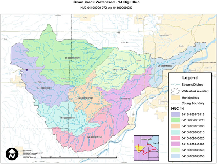
Fig. 7.2 Swan Creek Watershed, Ohio
(MRAC
2006
). The Swan Creek Watershed occupies approximately 204 square
miles in portions of Henry, Fulton and Lucas Counties, Ohio (Fig.
7.2
). Over
200 miles of creeks and ditches drain this watershed (MRAC
2006
). The main
stem of Swan Creek is only about 40 miles long. More prominent tributaries
within this watershed, from downstream to upstream, include Wolf Creek, Cairl
Creek, Blue Creek, Gail Run and Ai Creek. It should be noted that both
Wiregrass and Prairie Ditches, which are included as tributaries in the Tenmile
Creek/Ottawa River watershed, also have the ability to drain into the Swan
Creek watershed (MRAC
2006
).
Both watersheds contain three rather distinct subregions, based on general
patterns of land use and predominant soil associations. All of the headwater areas
in the Tenmile Creek/Ottawa River watershed, and a portion of the Swan Creek
Watershed, exists in a predominantly agricultural area of eastern Fulton County
and northwestern Lucas County. Here soils consist predominantly of Hoytville-
Nappanee-Mermill Association, which is described as a level to gently sloping
very poorly drained and somewhat poorly drained soils that formed in glacial
lake sediment (Mack
2007
). Tributaries within this portion of both watersheds
tend to be low gradient systems that have historically been within this subregion