Geology Reference
In-Depth Information
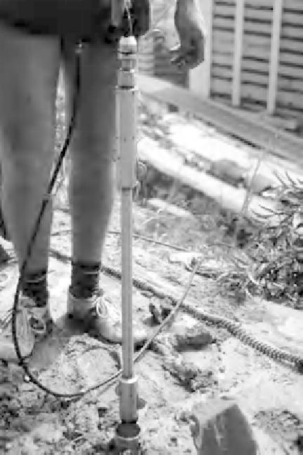
Figure 4.45
Inclinometer
lowered down
grooved tube. Tuen
Mun Highway,
Hong Kong.
areas underlain by salt deposits, old mine workings or karst),
coastal erosion, wind, rain or earthquakes (Bell, 1999). As noted
earlier, for some locations there are published hazard maps, but
such maps cannot usually be reliedupononasite-speci
cscale.It
is up to the site investigation team to identify the potential hazards
for the project throughout its life (maybe 50 to 100 years) and to
quantify these. In some cases, such an assessment might lead to a
decision not to proceed with a project. Elsewhere, the hazard can
be dealt with by careful design, and the main example of so doing
is the hazard of earthquakes.
Landslides from natural terrain (rather than man-made slopes) are a
hazard in most mountainous regions and can range from minor rock
and boulder falls to massive landslides which involve >20million m
3
of
rock and occur on average every three or four years worldwide (Evans,
reported by Eberhardt et al., 2004). Landslides like the one that
destroyed Yungay, Peru,
in May 1970, and killed about 20,000
people, are very dif
cult to predict and impossible to engineer. All