Geology Reference
In-Depth Information
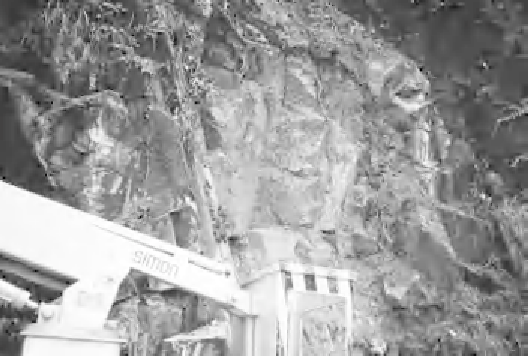
picker platform
used to examine
recently failed rock
slope to allow
remedial action to
be determined,
Hong Kong.
500
0
illustrated in
Figure 4.15.
Once the broad units or zone boundaries
have been identi
ed, then each needs to be characterised by systematic
description and measurement, as shown schematically in
Figure 4.16.
Evidence of seepage should be noted; lush vegetation can be indicative
of groundwater. The distinction between engineering geological map-
ping and normal geological practice is the emphasis on characterising
units in terms of strength, deformability and permeability, rather than
just age (Dearman & Fookes, 1974).
Some of the equipment that might be used in
field characterisation of
exposures includes safety harness, tape measures, hammer, knife, hand
penetrometer, Schmidt hammers (type N and L), compass/clinometer