Geology Reference
In-Depth Information
Figure 4.8 Spring
line revealed
following heavy
rain at base of
Carboniferous
Kilnsey Crag, West
Yorkshire, UK.
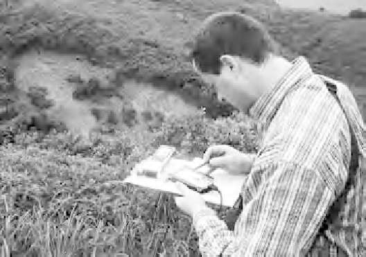
Figure 4.9 Hand-
ortho-corrected air
photographs and
terrain maps, used
to locate and map
natural terrain
landslide. GPS used
to get accurate
locations of
identi
ed features.
ts to be gained from mapping freely
available or cheaply created surface exposures to determine local
geology, they are particularly important for characterising aspects of
rock structure such as roughness and persistence of discontinuities,
which cannot be determined in boreholes. As for all measurements,
however, extrapolation should only be made with caution and with
awareness that structure and rock quality may change rapidly from
location to location (Piteau, 1973). Exposed soil may be desiccated and
stronger than soil at depth; exposed rock will often be more weathered
with closer and more persistent fractures than rock only a few metres
in from the exposed surface.
Apart from the general bene