Environmental Engineering Reference
In-Depth Information
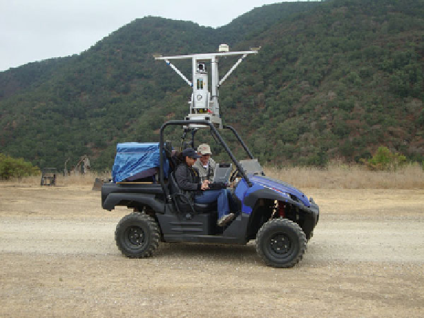
Fig. 2.14 An example of mobile terrestrial LiDAR positioned by RTK GPS and an inertial motion
sensor that was used to map large tidal wetlands in central California
2.3.2.7 Light Ranging and Detection Technology
LiDAR technology offers the ability to survey extensive wetlands with great
efficiency and precision. LiDAR is an optical system that sends out several thou-
sand laser pulses each second and records various aspects of the reflected light. In
topographic surveys, the primary variables are the direction and distance the laser
beam traveled before it was reflected back to the sensor. Those variables are used to
calculate an X, Y, Z position to the reflecting surface (e.g., plant, ground, building,
etc.). LiDAR has the advantage of shooting thousands of X, Y, and Z points per
second from a plane or terrestrial platform, but it has a disadvantage of not being
able to easily penetrate water or very dense wetland vegetation. There is currently
some experimentation to achieve better water penetration using various light
wavelengths. Aerial LiDAR data sets are available from public internet sources
including the National Center for Airborne Laser Mapping (
http://www.ncalm.cive.
State University Monterey Bay has engineered a mobile LiDAR system that can be
attached to an all-terrain vehicle (Fig.
2.14
) to precisely digitize soil erosion rates.
The early results are very promising, but the instrumentation is beyond the budgets
of most practitioners.