Environmental Engineering Reference
In-Depth Information
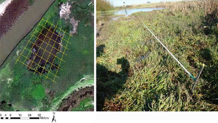
Fig. 2.8 Grid layout and photograph of baseline tape with one crossing tape
resurveyed at precisely the same X, Y points through time. If the elevations are not
resurveyed at the same place, elevation differences might be related to space rather
than time. The following description provides a means of locating your survey
points for time series of bathymetric change (e.g., monitoring siltation levels). You
can place two pieces of rebar in the ground, and stretch a long metric tape between
them. One of the rebar pieces should be held as the horizontal benchmark. That
point will be considered the horizontal origin for the survey and assigned X, Y, and
Z coordinates. The tape stretched between rebar stakes forms the baseline, and
another tape (or tapes) can be set at right angles to the baseline tape along certain
horizontal offsets. For example, if the crossing tapes are set at 4 m intervals along
the baseline tape, and the elevations are recorded at every 4 m along the crossing
tapes, the result is a 4 m square grid of points that can be reconstructed reliably at
future times (Fig.
2.8
). The choice of spacing will be based upon the time limits and
precision requirements of the particular project. An analysis later in this chapter
illustrates the benefits of closer spacing. Also, this grid pattern can be established
with just two tapes. One is the baseline tape that does not move during the survey,
and the other is the “crossing” tape that can be moved along the baseline tape for
each subsequent transect. If many persons are involved, you should bring more
crossing tapes which will speed up the process considerably.
Once the sampling points are established, the Z value of the wetland bottom can
be obtained by determining depth from a vertical reference point, such as the water
surface (Fig.
2.9
) or by using an autolevel or rotating laser level which will be
discussed in the next sections (Table
2.1
). The easiest way to measure the Z value
for each point in the grid is a depth measurement using a meter stick or survey rod.
In this case, the water surface is the vertical datum from which the measurement is