Database Reference
In-Depth Information
A symbology is a notation for the features in a feature class. A given feature class might
have multiple symbologies based on its attributes.
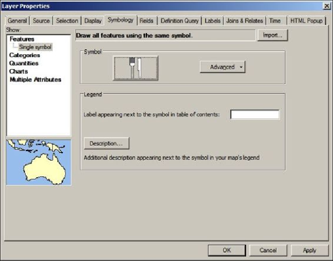
1. Double-click on the
Belize Restaurants
layer to view the
Layer Properties
dia-
log box.
2. Click on the
Symbology
tab.
3. In the
Symbol
section, click on the red dot and select a restaurant icon; type
Restaurant
in the filter box. The dialog box will look like the following
screenshot:
4. Close the
Layer Properties
dialog.
Now, it is time to add some features. Before we do so, make sure that you close ArcCata-
log and that you do not have any connections to your geodatabase. Now, to display the
Editor
toolbar, perform the following steps: